Measuring trail distances by setting waypoints

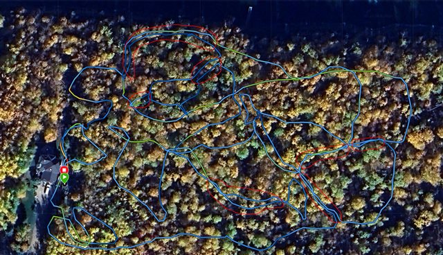
I have a network of trails created over the years and would like to measure total distance of the trails. When I walk them I can’t do it without backtracking over some of them several times so have to guesstimate how much of my 2.4 Kms was backtracking. 

I have an app on my iPhone 15 that can apparently do it, but I think my Fenix 7 Sapphire would be more accurate. When I  use iRunner and my watch to measure distance traveled when I go for a walk or a run they are close to the same up to about a kilometre then the iRunner starts creeping higher, often recording up to 500 meters more on a 5km walk.

Is there a way I can walk the entire network setting multiple waypoints and just get total distance, without overlap or measurements between waypoints that aren’t part of the trail network, either on the watch itself or the app? 

Looking on YouTube I’m just finding how to navigate a trail using waypoints, not finding out distances traveled. I would imagine I’d have to create start and end waypoints for each trail segment to avoid overlap and measuring between waypoints that are on two different segments then add the distances up, so I’m hoping I can do this with the watch. 

Top Replies

All Replies

  • If I understand what you want:

    1. pause the activity when you don’t want to track distance. 
    2. Stop the activity and resume later , or

    3 turn off auto lap then manual lap each segment. After you can add up the segments (laps) you want and ignore the others.  Load the track into Google earth if you want to visually check out the segments. 
    4. load the complete track into Google earth ( or other app) and draw over desired portion to measure distance (lots of extra work). 

  • I'm not exactly sure what you mean, but you can save 'waypoints' in the watch while you are out. 'Saved locations' they are called in watch. You can assign a hotkey to save ( maybe right top right button by default).

    What I know, you can't create a complete route on the watch of several saved locations.

    If I recall right, you can sync them with the Garmin Explore mobile app and create a basic route in there to get a total distance for them.

  • thanks for replies

    I have a network of trails I built over the years, many of them interconnected. 

    I am just curious what the combined distance is of all the trails.

    It's impossible to walk them all without walking over some sections twice, so when I am using walking activity to measure, I am not getting an accurate distance. 

    I guess I could walk each segment, save it, start a new activity, walk another segment, save, repeat, until all are covered then add them all up manually, but I was hoping there'd be a way to record waypoints and add the distance between all the waypoints without duplicating any segments.

    Uploading to google earth would be cool too so I could see where they all are, I can do this with a walk where I have backtracked/walked twice  over some segments but some of those show as double lines. I think with waypoints I can average them to get them more accurate. As you can see with the attached screenshot where I walked them all, there's a few places (outlined in red) where I walked the same path twice that show up as two separate lines when they should be one. 


  • A little technical maybe, but I would have saved my walks as gpx files. Opened them as background at https://www.openstreetmap.org/ or in the vespucci mobile app. Gone into edit mode and drawn the paths on OpenStreetMaps. 

    After a couple of days the paths could be seen on all route planners out there (almost everyone supports OpenStreetMaps).

    Then you could create courses/routes for your watch and measure in all possible ways.

    Then updated my maps on the watch and seen them there too.

  • I think you are not using the term "waypoints" in the way most of us understand.  A Waypoint is a specific spot on a track - the distance between them is a straight line distance.  You want to break the whole track into segments that isolate the individual trails from any duplicates.  Your thought of doing each as separate activities would work but I'm not sure why 1) or 2) from my suggestions would not easily do what you want.  Both will provide a single activity with a total distance over only the portions you want to count.  Separate activities would require some math but it would also allow you to do stuff with each section if you wanted.  Lots of ways to do it, each with pros and cons depending on how you want to deal with the data.  Also lots of tools to convert, split, add segments together.

  • I think I see what you mean. When I use waypoint I mean every point on a given part of the trail that has a bend or curve. I read somewhere that you can average the waypoints and make them more accurate. I envisioned waypoints throughout the entire trail network so that the series of straight lines between them would be an accurate measurement of total distance. I see that it will have to be done in separate segments, and I was assuming that setting multiple waypoints for each segment would be more accurate than just walking each segment and saving it.   

  • What you are describing is what the recording and resulting fit file, tcx or GPX file contains - a point once a second. Export a tcx or easier to deal with, a GPX file - both are just text files that can be opened with any text editor.  For what you need you can just use the built in features, either by pausing during the sections you don’t need or stop with resume later - both will then just show the total distance you want on the watch or in the mobile or pc app.  Using laps to mark would require a bit more work - subtract lap distance of unwanted segments from total.  No need to dig in any deeper unless you want to do more. 
    edit:  make sure recording is set for per second and if using laps make sure auto lap is not on. 

  • So if I pause a walking activity or stop to resume later it doesn't join the end and start points?  I thought pausing just stopped recording time & movement then continued on from where it last left off.  

  • No the distance you move during a pause is not added in (or a Resume later).  If you look at a track in Garmin Connect with a pause, it will show a straight line between the two points but the distance is not included as it has no idea what path you actually took and you have paused.  I just did a walk down our driveway - went 150M down, Paused, turned around and came back about 80M then started the watch again and continue to the start point - total distance for a total of 220m.

    Only thing to watch for is the pause will time out - can't remember the length of time - it will vibrate and then, if not confirmed switch to 'resume later'.  or just use resume later depending on how long the segments are that you want to skip.

    https://drive.google.com/file/d/1P6zU5NZo_zwQaS9ebLQMDzpq8EjZ11m9/view?usp=drive_link