How to load GPS waypoints directly into watch folder?

I have some waypoints that I created manually in a gpx file. I wish to load these waypoints into my watch (Tactix 7 Pro) so I can use them as saved locations or reference points.

How can I directly transfer the waypoints into my watch folder using the Android File Transfer app on my Mac desktop? What format should the file be in, what should the filename be and in which folder should it go?

I tried converting my .gpx file to .fit and copying it into the watch's Location folder as Lctns.fit, but it did not work. The watch said "no locations saved". Copying the gpx file directly into the folder did not work either.

I imported the waypoints into Garmin Explore and tried syncing them to the watch, but after syncing, I could not find the waypoints in the watch.

I installed BaseCamp but it crashed soon after launch. I just wanted to load a few waypoints into the watch, but I couldn't even get past the opening screen of that software.

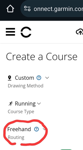
I do not wish to pair my watch with my phone, so Garmin Connect is not an option.

Has anyone managed a direct loading before?

  • So I tried that. Start point, middle point and end point. With follow track it navigates directly as supposed, but with use map, it´s somehow messed in 15.69 beta. It calculates the route, but shows direct line to place before next point, then it follow routes for a while a then again straight line near the end point and short part follow the routes. So the use map option works correct only with creating a route from points in watch. 

  • I tested myself now to create a route with 5 gps points with straight lines between them in GC web. I got really strange routing results when using 'use map'.

    When I now look at the file from watch with https://www.fitfileviewer.com/, I can see that it contains 61 gps points, one every 30 m. That results in that routing is done between those points that often were inside buildings and not in a routable place (road or path). I'm pretty sure that this is not how it was a couple of years ago when I tested with my f6x.

    The strange thing is that if I export it from GC web in GPX format, I get a file with my 5 gps points (track points).

    Plotaroute still gives me 5 gps points when downloading as a fit file that watch can route between in 'use map' mode.

  • I'm glad that so many details on the subject are being discussed on this thread that are helpful to users. There are many subtleties in routes that I didn't think about. Please continue the discussion!

    But for myself, the conclusion hasn't yet changed from the day I first decided to procure the watch.

    To navigate, I don't use the watch (except perhaps for the compass/altimeter). I have a real topographic map printed on A0-sized paper by the country's survey department, with a waterproof map case. You can see the entire area you're in all at once, along with the small details in high-definition print. You can easily make markings on the map. It gives you more awareness of where you are, which way you're going, and appreciation of the beauty of the terrain around you, than even the largest Garmin watch faces, which are only 280 by 280 pixellated pixels if I remember correctly.

    The main purpose of my Tactix 7 Pro is to give me the most accurate all-satellite multi-band GPS fix possible in thick, mountainous jungle, when I wish to record a location of interest or cross-check my whereabouts. And perhaps show me the bearing and distance to a loaded waypoint (in relation to my original question in this thread).

    The other main purpose of the watch is to look macho, whether in the field or at a dinner party, where I switch to the chestnut leather quick fit band which makes the watch look really classy. I use the Luftwaffe pilot Flieger Type B watchface by steam.gauge, which looks equally good in the fighter cockpit or at the White House. If you think about it, there are watches that cost 10 times more, look worse and have no GPS. Anyway this is going off topic.

    Perhaps as I gain experience, I will refine the way I use the watch.

  • I agree that the watch map is nearly useless for navigation in a traditional sense. The way I use my Fenix 7X for navigation in nearly 100% of cases is that I load a course and just follow it using the map to provide additional context. All I need to know most of the time is whether I am on the course or not. When I come at a tricky intersection where it isn't entirely clear which way to go, the watch map usually has enough context to help me pick the right path.

    Most of my navigation usage is during trail running where I often move fast and sometimes at night. There is absolutely no time to pull a large map and spend minutes looking at it. How even would I carry it? Even pulling a phone to use an offline map takes way longer than a quick glance at the watch map. I've done many successful multi-hour runs on complex trail networks where I relied entirely on my watch to navigate. I still carry a phone with offline maps as a backup but rarely need to use it.

  • I think you have highlighted a good point. Although I don't do trail running, there could be situations even for me where following a predefined course is necessary for scientific research or whatever unforeseen purposes, and I may not have time to use a paper map or even have a paper map of the area of operations. Now the capabilities of the watch will be really handy.

  • I can see that it contains 61 gps points

    That´s really strange! I´ll try it again and post the porblem to beta reports forum.

    I think, that even if I place the points to buildings, etc.., it should navigate by roads/pathways to neariest point on the road next to the point, then directly to that point and then directly to neariest road/pathway on the direct way to next point. If it´s understandable :-)). Maybe there is a problem with selecting route, if there isn´t any in direct way to next point? 

  • contains 61 gps points

    That´s really strange! I´ll try it again and post the porblem to beta reports forum

    But it's a GC problem, not in the watch. The fit file export on GC web gives me the same 61 points file as the one in the watch.

    So if using the freehand mode in GC to select route points you want to pass and want the watch to route between, GC produces fit files with GPS points every 30m. The watch then are going to route you to the closest gps point on the straight line instead of next route point. Both the fit sent to watch and the GC exported are the same.

    On the other hand, the GC exported gpx file contains only the selected route points (as track points) and then you can get the expected behavior. (Not tested)

  • I personally don’t like flags as position markers as they take up a lot of space, block the map details behind and you’re not 100% sure which part of the flag symbol is marking the exact coordinates (although it’s probably the lower tip of the pole)

    I looked into this deeper. Both to get other predefined symbols and to use personally created custom symbols in manually created gpx files. Both are documented 'features' for Garmin gps devices.

    I didn't succeed. Anyone know if this has ever worked for epix/fenix devices?

    ------------

    https://support.garmin.com/sv-SE/?faq=VTS8XTdjCW5Tx3HyfJ3eQ6 (In Swedish)

    • Waypoint symbols should be saved in a 24-bit Windows-style bitmap format (*.bmp).
    • Waypoint symbols should not exceed 32 pixels in width and height.
    • To make a pixel transparent, set its color to magenta (RGB = 255, 0, 255).
    • Replacement symbols can be assigned by editing the <sym></sym> element in the waypoint’s GPX file (i.e. “Flag, Blue.bmp”).
    • New symbols can be given any other file name (i.e. “New Symbol.bmp”).
    • Modern (mass-storage) devices are limited to a total of 56 custom waypoint symbols per device.
    • Symbols must be saved to the device (not the microSD card) in the [GPSr]\Garmin\CustomSymbols\ directory.
    • By default, a symbol displayed on the map will be centered on the waypoint coordinates.
    • To adjust this ‘hot spot’, include the desired center position offset from the upper-left corner in the file name.
    • Example: “Anchor.10x20.bmp” will be centered 10 pixels to the right and 20 pixels down from the top left corner

  • I tried this with a f6 pro a while back without success. 

  • It works on my Montana but couldn’t make on my F5X.

    Remember it will only work on your device … so I found it not cool.

    I love and hate Garmin navigation environment.

    At one hand we have a watch we can have several maps including kmz’s and “IMG’s from GPX”, waypoints, warnings, turns, tracks & courses ( I never use routes) but at the other hand we can not see multiple colored tracks (like we used to) and we have to use SEVERAL 3rd parties apps and finally but not lest we have to use an CABLE!!! in order for all that to work …

    LOL