How to load GPS waypoints directly into watch folder?

I have some waypoints that I created manually in a gpx file. I wish to load these waypoints into my watch (Tactix 7 Pro) so I can use them as saved locations or reference points.

How can I directly transfer the waypoints into my watch folder using the Android File Transfer app on my Mac desktop? What format should the file be in, what should the filename be and in which folder should it go?

I tried converting my .gpx file to .fit and copying it into the watch's Location folder as Lctns.fit, but it did not work. The watch said "no locations saved". Copying the gpx file directly into the folder did not work either.

I imported the waypoints into Garmin Explore and tried syncing them to the watch, but after syncing, I could not find the waypoints in the watch.

I installed BaseCamp but it crashed soon after launch. I just wanted to load a few waypoints into the watch, but I couldn't even get past the opening screen of that software.

I do not wish to pair my watch with my phone, so Garmin Connect is not an option.

Has anyone managed a direct loading before?

  • I think this is all avoidable by calling everything a route and giving the user the option “reroute = yes/no?”. This would be more idiot-proof, not requiring the user to know the difference between a “course” and a “route” according to Garmin’s own definition.

  • There is still more difference.

    A route may consist of just a few waypoints that are far apart or perhaps just one destination point. A route can use direct navigation rather than device map routing, for example when sailing.

    In contrast, a course has to be very detailed because it doesn't allow an alternative interpretation. It should be possible to follow a course off trail or without a map.

  • Technically, in the 'old' GPX world, route and track are different things.

    GPX route consists of route points. To build a GPX Route, for instance plotaroute do not take every GPS point on the track, you have the option to use your directions or POI's to build the route.

    <rte>
    <name>GpxRouteDir</name>
    <rtept lat="59.335846" lon="18.313123">
    <ele>42</ele>
    <time>2023-11-06T00:00:00Z</time>
    <name>S </name>
    <cmt>S </cmt>
    <desc>S </desc>
    <sym>Flag, Blue</sym>
    </rtept>

    GPX track consist of track points. Every GPS point needed to exactly show the track become a track point.

    <trk>
    <name>GpxTrackDir</name>
    <trkseg>
    <trkpt lat="59.335846" lon="18.313123">
    <ele>42</ele>
    <time>2023-11-06T00:00:00Z</time>
    </trkpt>

    When using GPX track, you can also add Waypoints, on the track or off the track. Usually they are found in the beginning of file, without distance tag. 

    But you can also create a GPX file with only waypoints. In the Garmin world they can't be selected as a course, they ends up in Saved locations where you can use them in what order you want.

    <wpt lat="59.3360904" lon="18.3084015">
    <time>2023-11-06T00:00:00Z</time>
    <name>Himlaberget</name>
    <cmt>Himlaberget</cmt>
    <desc>Himlaberget</desc>
    <sym>Summit</sym>
    <type>Waypoint</type></wpt>

  • A route can use direct navigation rather than device map routing, for example when sailing.

    And this doesn´t work for me in latest beta. If I have "use map" enabled and create new route from two points added from map, everything works and the route is calculated in the watch. But if I switched to "follow route", nothing happens, the watch doesn´t show direct lines to these two points, neither show the distances to this points (shows --.-- or something similar). Or we can´t direct navigate to only one point? Could someone try that please too?

    I have next questions. If I make a route in GC, I put e.g. five course points in map and GC makes a route from this. After sending this to watch and start navigating, we should have two possibilities. First with "follow route" option, we should get exactly the same, what we see in GC. Next with "use map" option, the watch should take only the five course points from the file (used for calculating a route in GC) and reroute a new course with using map in watch. Is that right? Or there is no possibility to create a route with course points only in GC with calculating the route in watch later, because we can´t see and edit the course points we used for creating a route in GC...

  • I have next questions. If I make a route in GC, I put e.g. five course points in map and GC makes a route from this. After sending this to watch and start navigating

    If you let GC be smart and create the course to follow roads/paths, then every gps point needed will transfer to watch and be used in both use map and follow course mode.

    I think you need to draw straight lines between the course points and send it to the watch to be able to get a route that watch handle in the way you describe with use map.

    In tests I did during my fenix6 days, the route calculation time in use map was a lot quicker with fewer route points like this, even if the resulting route in watch became the same.

  • I think you need to draw straight lines between the course points and send it to the watch

    But I think, this is not possible in Garmin connect. Maybe in Mapsource or the second tool (I can't remember the name now).

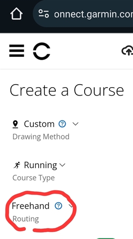
  • I seems not to be available in app, but in GC web on mobile it's possibly. 

  • create new route from two points added from map

    My plan is to test this tomorrow, but I'm not sure what you mean by this. Do you mean it's possible to create a route on watch from/between two Saved Locations that you have saved from map earlier?

  • Yes, but starting point is Your current location and it draws straight line to first point. You can select more locations one after another. Or You can select this points from map, or POI´s, etc.