Hello again,
I now learned, that I should adress findings as soon as possible, so here is the next one which I like to be reviewed and hopefully verified in the community.
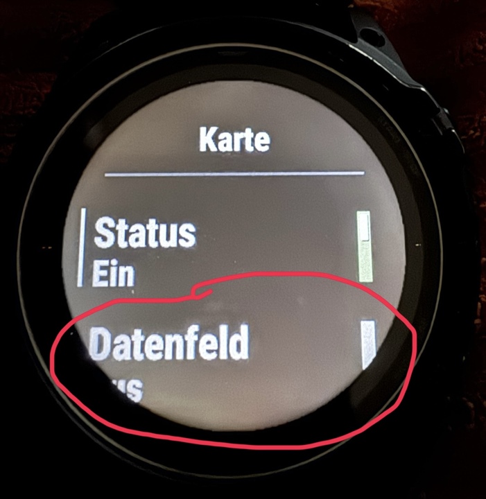
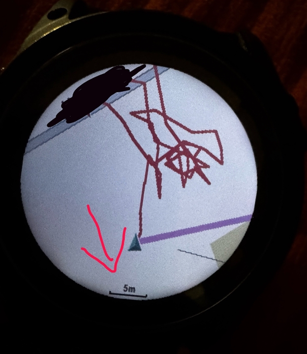
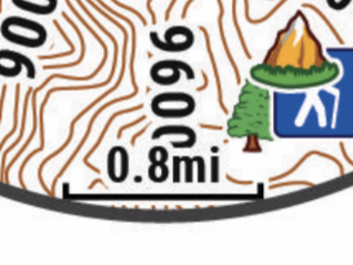
In the map datafield, there is a little rangescale, which changes depending on zoomlevel (see excerpt from handbook).
This scale is visible and working, when no navigation, track or similar is used. However, if navigation is on, the scale disappears.