With the Fenix 7 series, Altimeter Auto Calibration does the following according to Garmin:
Auto Calibration On
Setting auto calibration to On calibrates the sensor at the start of an activity. This will provide a consistent relative starting elevation if you do multiple activities at specific locations. When the timer is started the watch will try to determine the best elevation source to calibrate to, based on the following priority:
- Manual calibration immediately prior to starting the activity.
- Prior manual calibration point at the same location.
- Recent manual calibration, if the quality of the calibration is determined to be good enough.
- Map data (DEM - Digital Elevation Map), if available.
- Prior Connected DEM point at the same location:
- Connected DEM refers to elevation data from the Garmin Connect app on a paired smartphone.
- Connected DEM, if currently connected to a phone.
- Prior GPS point at the same location.
- Save Location immediately before starting the activity will also count toward calibration.
- GPS, if a good fix has been acquired:
- After acquiring a GPS fix the timer ring will turn yellow. At that point, it can take up to 30 seconds for the GPS elevation to settle. If vertical speed settles to less than .1 m/s the GPS elevation data will be considered good enough use for altimeter calibration.
- When the timer ring goes green the altitude is now calibrated.
[ Source: https://support.garmin.com/en-US/?faq=pCL0xvX9lj8hdtZcNf1ZAA ]
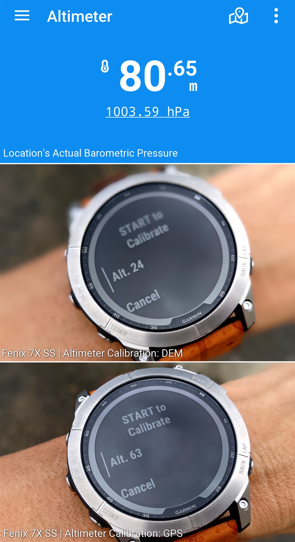
What happens when there is a significant difference between the values used in exactly that order of priority at any given location? An Android app I use reports the location's actual air pressure through Google Pixel 3XL's BOSCH BMP388 precision pressure sensor vs DEM vs GPS. Would a Trail Run activity's Total Ascent be affected by such disparity while auto calibrating during activity?