Hey,
any ideas? Starting activity yesterday...GPS Fix, and go. Today? Exact the same, also the same track.
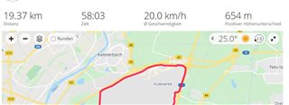
Off Track today.
Exact the same Track yesterday.
Hey,
any ideas? Starting activity yesterday...GPS Fix, and go. Today? Exact the same, also the same track.
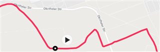
Off Track today.
Exact the same Track yesterday.
There are multiple reasons for this to happen, but in short it means the watch lost connection with one or more satellites, because of trees, clouds, tall buildings, microwave interference or whatnot.…
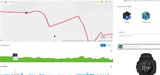
At Instinct the elevation data comes from the barometric altimeter, so the GPS signal has no influence on it.
Yes and no. GPS (or DEM) is used to determine elevation every time the altimeter…
Honestly, I don't remember what is the default setting, but I keep auto-calibration on and it has been accurate enough for me.
And you are absolutely right. I've noticed the elevation differences when…