InReach Explorer Plus map inconsistencies on zoom

Former Member
Former Member
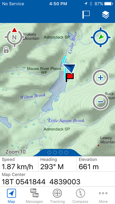
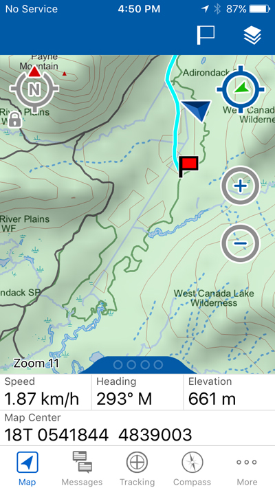
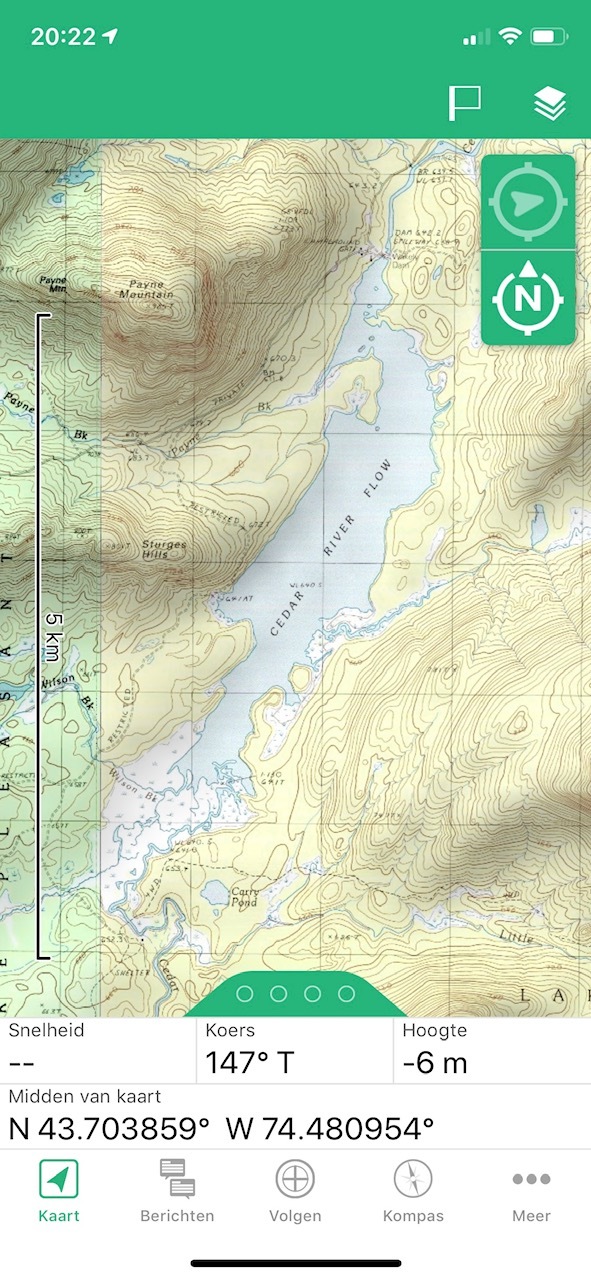
In the brief testing I did this past weekend in the Adirondacks, I'm finding some inconsistencies in the map. For instance, the amazing disappearing lake. I was camped on the shore of a lake and in the zoomed out view, it was visible, however one zoom level in (and all subsequent zoom ins) the body of water was completely missing from the map. I also noticed some lake names changing to incorrect names on zoom. Has anyone noticed this? Is it a problem in these maps? I realize small inconsistencies are to be expected, but a whole lake gone missing? That seems excessive. These screenshots are actually from the Earthmate app via bluetooth, but they accurately show what was on my Explorer + at the time.
ciq.forums.garmin.com/.../1253902.jpg ciq.forums.garmin.com/.../1253903.jpg
  • Can't speak to this particular area. I suspect that what's happening is that you are crossing the boundary between the base map (or Digital Atlas of the Earth) and the theoretically more detailed DeLorme TopoNorthAmerica state maps. If I ever knew, I cannot now remember what zoom levels are covered by each of the maps.

    I am also not entirely sure that the maps are the same between the Earthmate app and the device. For example, here in Missouri, the device has a worldwide base map which (as far as I can tell) is not available in the iOS version of the Earthmate app. Both platforms support DAE, though.

    Either way, pretty sure the issue is that the more detailed map lacks the water feature that is present on the less detailed map.
  • Former Member
    0 Former Member over 7 years ago
    Interesting. The same thing happens on the device, which is where I first noticed it. Other nearby bodies of water seem fine - odd.
  • Former Member
    0 Former Member over 6 years ago
    How do I report things like this? Is there a way to get the detailed map updated?
  • How many maps are switched on? I get the same result with the Topo North America map. Normal it's the other way around, if you zoom out detail disappears, now if you zoom in detail disappears. I tried the USGS topographical Maps, and they work great and have more contour lines and a bit more detail.ciq.forums.garmin.com/.../1423792.jpg
  • I an having issues with zoom, basically the map doesn’t even load. I thought it was because I had crosses into Canada but I tried changing map bases and that didn’t seem to fix if

  • Based on a quick review of support articles: Not all maps are available at all zoom levels. Preinstalled maps depend on the region for which you purchased the device. Downloadable maps vary by region. 

    This thread is so old that nothing here is likely to be relevant today.

    Open a support ticket.