More detail on maps

I recently upgraded to the 5x (Big Fan!!!) because I've started to use the watch to navigate on my trail runs.

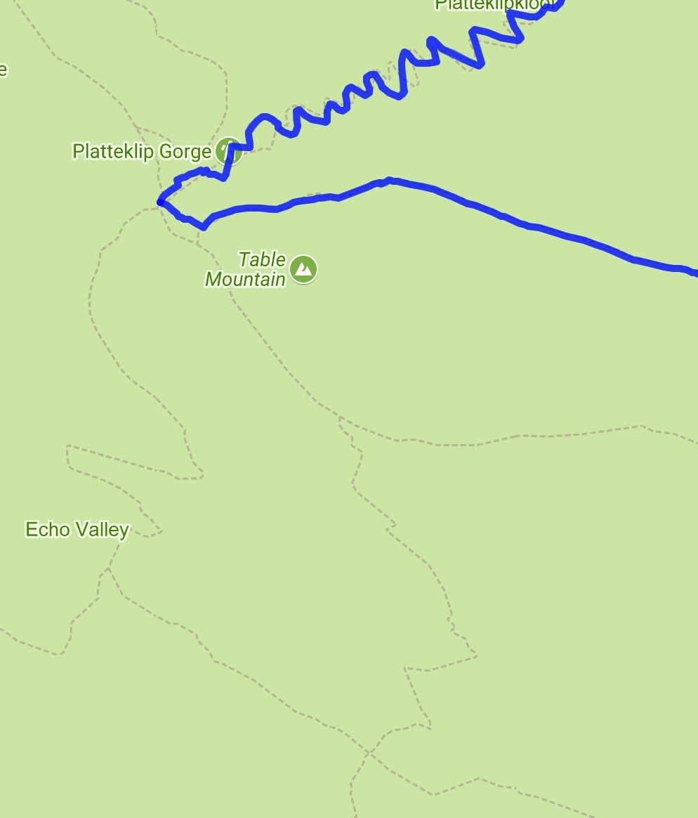
I currently use dynamic watch to plan the route and send the route to my watch then use the app on the watch to navigate how ever i am struggling a little when it comes to following the route - often I am running along a path and it spilts into a Y and the line on the watch im following isn't obvious which path to take.

Is there a way to show the tracks in the area so i know when im going to other paths?

I have selected "show more detail on map" but this didn't change anything.

I am running the latest software, am based in Cape Town - South Africa and Im guessing using the standard installed maps.

Please note - i DONT want TOPO maps with all the contours as my simple dyslexic brain can't understand them - especially when out of breath and 10km into a run!!!


Thanks in advance

I have attached an example of the paths from planner and am hoping for something similar on the watch


ciq.forums.garmin.com/.../1298650.jpg
  • There should be some Open Street Maps (OSM) you can use.
    Google is your friend. :)

    EDIT:
    Check out THIS THREAD on maps.
    In the last comment I posted some links to free downloadable maps.
    Don't be turned off by them being topographic, at least some have the contours as a separate layer that you can turn off.
  • Thanks Robert

    So if I load the South Africa Map on the link you posted it will show more details about the paths? (Sorry im very new to all this)
  • Not sure I completely understand what you are going for but I will note a couple of things that I have learned. Firstly, when it comes to trails, not only will many of the map sources be inaccurate (compared to the actual trails), different maps (google, garmin, OSM etc) will often have a very different level of completeness and accuracy, especially in less traveled areas. i don't think this should be a surprise as you can even see this with roads in some areas. I find it a good idea to make sure that when I make a route to upload to the watch, I use the same map source to make the route as I'm using on the watch to follow it. At least then the watch will not be showing a route section that is way off from the map trail (or no map trail). This does not help when the actual trail does not match the map anyway - so you get constant reminders that you are not on the course because the actual trail is 75m south of the placement on the map! I have learned where certain maps are better than others and will switch both the route making map and the watch display map to match the best choice. I will also look at different maps for an area to try to determine which has the most up-to-date trail mapping. For complex routes, I will customize the TBT details - plus I always carry a paper map. Regardless, I have learned to use the watch navigation more as a guide! Even where I live, on google the overlay of the road I'm on shows up about 50m off from satellite view.
  • You're welcome!
    Like razmichael noted, your milage may vary. Different detail and correctness for different areas.
    Also, I have found that when using satellite imagery and zooming in it can get WILDLY inaccurate. Zooming out a bit actually gives much more accuracy in many situations I have seen.

    Check out this video or others like it to learn more about how to install the maps and adjust settings for which maps to actually use on the watch.
    https://www.youtube.com/watch?v=Fhyua8mXXF0