Sorry I wasn't very clear, I'm looking for an easy way to have my walk showing on the map and a redline showing my route. I've done it once but lately don't seem able to do it again.
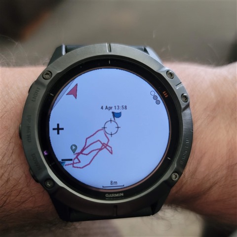
I just tested it myself. Just starting a walk and switching to the map the red line is drawn as I walk with no preplanned route. This was just walking around my back garden. Make sure the zoom scale is appropriate to show something.
That's because it is zoomed into my back garden. You can see a street in the top left edge of the display. If I zoomed out or panned the map you would see streets shown.
Within the Walk app I have two screens configured. One is some data fields. The other is the map. Simply start the Walk and scroll to the map screen. The red track should appear automatically as you move.