Altitude : barometer or GPS

Former Member
Former Member

Hello,

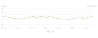
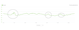
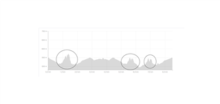
I have a fenix 5 plus. After activity, my watch is giving me total elevation + and -. If I'm applying elevation correction in Garmin Connect or Strava, the value is really higher.

By example, yesterday I did a run, my watch said +185m, in Strava after elevation correction +280m and in Garmin Connect after elevation correction +320m that is really much more.

My question is very simple: which one should I believe?

  • The answer is also simple: It depends Wink

    The correction is done with data from the maps and as Garmin and Strava use different maps, this explains the difference between the two.

    In principle the barometric measurement is more accurate because it measures your movement. Errors occur when the ambient pressure changes during the activity. 

    I have switched off the automatic calibration via GPS during an activity, because GPS-height is in principle not very accurate and can also cause errors. I calibrate the height manually before I start an activity. For very long activities and if the weather changes a lot (especially near storms) it might be better to have this calibration on.

    The difference between the measured and corrected values are normally smaller than the numbers you mentioned. The reason can be a missing or a wrong calibration, a defective barometer or thermometer, wrong data in the maps, a storm or anything else. Does the height-profile look reasonable or are there jumps (both the measured and corrected)? Are the height at start and end almost the same (assuming a round course)?

    Maybe you find the answer.


  • Former Member
    0 Former Member over 4 years ago in reply to RunR

    Thanks for you reply, it helps me a lot and now I understood also by comparing profiles.

    This is profile from my watch:

    This is from garmin connect with correction:

    And this from Strava wiith correction:

     0

    We can observe some pics on the corrected profiles, these are not existing. This happened only because I'm in a mountain area, and at the pic location, I'm running very close to the montain. So with GPS error, the system believe that I'm running at really higher altitude.

    So in this case, I should not use GPS, barometer from the watch is really better.

    And when I'm making small calculation with correct altitude, it seems in fact that the watch is very close to the reallity. 

    And for you iinformation I'm using auto-calibration during all activity, I will try next time on same run to unactivate.

    Thanks!

  • And for you iinformation I'm using auto-calibration during all activity, I will try next time on same run to unactivate.

    Good. In exactly this environment, it will probably be a very good idea to disable auto-calibration.

    The auto-calibration does not use the GPS data directly. Instead, it only takes your 2D location from GPS and then looks the altitude up in an internal map. This is actually quite equal to the procedure, which is used by Garmin and Strava for elevation corrections. 

    So if you run very near to a hillside or a steep canyon, your risk that your auto-calibration will be fooled in the same way as elevation corrections were fooled by your recent run.

  • Here Garmin explains more details, interestingly not in the manual:

    'During activities the watch uses DEM mapping data, and GPS elevation to offset any altimeter drift ..."

    support.garmin.com/.../