Is InReach service reliable?

I just bought the InReach Mini 2 and an annual recreational plan.  

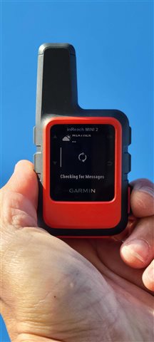
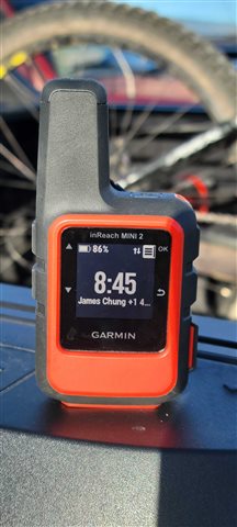
I have been testing it to learn the user interface and its effectiveness.  So far, my impression is "janky." More seriously, I fear that it will not save my life in real life situation.  Here is my data...

1. Tested in the backyard with a clear view of the sky (no cloud, 95125 zipcode)

Even after letting the unit "settle in" for 5 minutes, the communication is laggy.  Fine, I'll accept that it's a tiny handheld transmitting with satellites.  But it makes me wonder "how many satellites do Garmin own up there?

I also get enough of the "GPS signal is poor, do you want to send it anyway?" This makes me wonder if I'll be cussing at Garmin as I am freezing with a broken ankle with a clear view of the sky. 

I have not done the same test under cloudy condition yet. 

2. Tested in Monterey Bay while scuba diving.  Paid for the expensive underwater case.   Tried to send the start and end preset messages on the surface.  Clear view of the sky.  Waited 5 minutes both times before "oh well, I'm just testing it" and gave up.  I eventually received the preset messages on my phone. Tried the tests both with case and without it.  

Before wasting more time holding my breath..

A) Is my expectation of InReach too high?  (i.e., marketing hype)

B) Is this device and service gonna increase my chance of rescue as I do "weekend adventure" activities in California?

C) Am I using this InReach Mini 2 incorrectly?

Thanks in advance. Pray

  • Just to make sure: you talk about the Mini 2 but have posted in the Mini (not 2) forum. Is it in fact a Mini 2 device you own? This does matter when talking about the responsiveness of the GPS receiver, so it's important to set that straight. I'm proceeding on the basis that you do indeed own a Mini 2.

    "how many satellites do Garmin own up there?

    The answer is: none. The inReach devices use the Iridium NEXT satellite constellation, owned by Iridium Communications Inc. There are 66 active Iridium satellites, orbiting in six planes of 11 satellites each.

    The first thing I tell people when teaching them how to use an inReach device is that they should not expect this thing to work just like a mobile phone that just happens to communicate via satellite. That's setting yourself up for disappointment at best, or getting yourself into a gnarly situation in the field at worst. You cannot expect the same snappy response times you'd get from a phone-based messenger when using satcom (at least, not from the Iridium network). Instead, view it as an email service with very short messages and a slow but reliable mail server infrastructure.

    When sending a message, what in fact happens is that the device queues the message for transmission, and then starts trying to contact a nearby satellite. There should always be at least one Iridium satellite visible from any location on the planet, but it could take a few minutes for it to get within line-of-sight and for the message to be transmitted. In a mountainous or urban environment with restricted views of the sky, this could take 10-15 minutes at times (but could also take much less time if you happen to have a sat overhead).

    So no, I don't think you're using the device incorrectly, but you probably do need to manage your expectations. Think "minutes" instead of "seconds" for messages to be sent, and you should be fine.

    As for the "Poor GPS signal" message: I do consider this more of a UI bug than something wrong with the GNSS receiver. The receiver in the Mini 2 is, in fact, hugely improved over the one in the Mini, and it will get a fix within seconds (especially without any nearby obstructions). The problem lies in that the device must first power up the GPS receiver when sending a message, then get a fix, and then add the coordinates to the message before transmission. My educated guess is that Garmin chose to pop up that "Poor GPS signal" message too soon; if they'd just wait a few seconds, the fix would be ready and the message could be sent without all the scary error messages. My advice would be to just ignore the message and select "Wait for GPS". The message would then be added to the send queue within a few seconds.

  • Thanks  for your gentle and thoughtful response.  Yes, I do own the inReach Mini 2.   My apology for posting in the wrong section.

    Garmin should hire you to write up the FAQs for their devices and services.   For example, I cannot readily discern the difference between "Wait for GPS" and "Send Anyway" when sending preset messages.    

    I do have the "minutes" mindset when using SatCom services.   As I wait for over 10 minutes in San Jose, California, at the trailhead with blue sky overhead, I wonder what this device is doing.  This kind of user experience makes me doubt its marketing promises. 

    Thanks again.  I'll use it for a year and cross my fingers that I don't use the SOS feature.  Cheers.

  • For example, I cannot readily discern the difference between "Wait for GPS" and "Send Anyway" when sending preset messages.

    "Wait for GPS" = wait to acquire a GPS fix to determine your current position, and then include that position in the message the device is about to send

    "Send Anyway" = send the message immediately, without including your current position

  • The issue with time to GPS fix is a result of aggressive power saving. The device does its best to keep the GPS radio OFF until needed. As noted above, you should just choose "wait for GPS". Especially in a situation where safety is the issue, DO NOT choose the "send anyway". This results in a message with no location information.

    I can't stress this enough: For safety in the back country, ALWAYS enable tracking (sent points via the Iridium network). Yes, yes I know. You signed up for the safety plan. Points cost money. You are talking about your LIFE here. This is not the time to try to save money.

    Why is tracking important? Because you might become disabled and unable to send an SOS message. Or you might be immobilized in a narrow canyon where Iridium communication is virtually impossible. When somebody eventually reports you overdue or missing, SAR will have your most recent track point as a starting location for the search.

    Note that the Iridium constellation transits from southwest to northeast. A narrow canyon which runs northwest to southeast is the worst possible location to try to send messages (or track points). In my limited experience, you might not be able to send from a location like this at all.

  • Really good advice from and (as always). I've been learning the hard way that Garmin's technical capabilities are always way ahead of its UI and UX capabilities, so user knowledge is hugely valuable.

    You mention "blue sky overhead" or such a couple of times. I can tell you this was my mistake: assuming a satellite in space is always high overhead. But just like with satellite radio in my car, even a 1-storey expanse of tract houses is enough to block out Mini2 reception when the birds are only on the horizon. I added a widget called IridiumWhere (CIQ) to my fenix watch, which indicates compass-like direction and angle to the nearest satellites at any given time. For home tests, standing in the front yard versus the back yard makes all the difference.

    (You also mention trouble while scuba diving. How deep? I don't dive but I don't know how well GPS is expected to work under water.)

    I got the Mini 2 because I like to hike solo in deep canyons in the SoCal backcountry. I did splurge on the recreation plan and send tracks during the entire hike. I am also training myself to send messages when I first get to a rest point so I can wait for signal and confirmation before moving on.

    Personally, I'm still trying to discover the limitations of the device and the service precisely so that I can have more confidence I will know how to use it in an emergency. 

  • Neither GPS nor Iridium communication works under water. Water does a fine job of blocking the signals. Garmin has a dive case for the M1/M2. But all it does is protect the unit down to 100M. In order to actually use it, you must surface. And you must hold the entire case out of the water.

    https://www.garmin.com/en-US/p/642729

  • He was on the surface when tried to transmit. The mini is a recommended tool for divers in areas with strong currents in case they're lost. I myself am interested too how well does the transmission work if the mini/mini2 is held 1 foot above the water in the real world.

  • Your experience pretty much matches mine. Hit or miss service for no real reason. I would really hate to need it in a life threatening situation. 

    On the rare occasion mine actually sends a text message, it can take up to 30 minutes. Very light tree cover kills it. Nearby hills or mountains render it useless. Clouds, rain, snow also limit its usability. 

    Garmin's marketing hype is way out of line compared to how this unit actually performs. If there's ever a class action lawsuit on this, they can count me in. 

  • This is atypical. Light tree cover or "nearby" hills/mountains should not be this big impediment. Of course, wet foliage is a bigger impediment than dry. But it's not the clouds/rain/snow itself - it's water on the barrier (tree cover, your pack, or whatever).

    30 minutes is way too long.

    Be sure you are are carrying the device in the ideal position - on a pack strap, on top of your shoulder. This minimizes the sky segment blocked by your body.

    If you are carrying it that way and still having problems, you can try a factory reset. This is a big hammer. You will lose all your data on the device. You will have to repeat the outdoor portion of device activation. But this is the conventional wisdom when an iR device acts up. It's probably the first thing tech support will suggest.

    If you still have problems after the reset, open a support ticket. You may have a defective device.