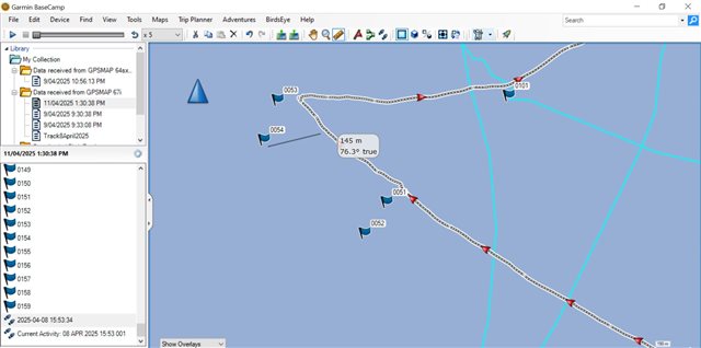
I was using a GPSMAP 67i on a boat to record the track (for the whole journey) and waypoints at certain points. When I loaded the data into basecamp, I noticed that the waypoints recorded (with the same device) were not very close to the recorded track. The median difference was about 30 m, but in some places the waypoint was completely wrong (by over 100km). To help troubleshoot I was able to download the vessel plotted data (a Lowrance system) which I recorded for most the trip. The Lowrance track agreed with the GPSMAP 67i track on average 3-4 m and looks a good fit when plotted on top of each other. So, I am inclined to believe the recorded track, but want to understand why the waypoint data is so different? I don't think it is a format or datum issue as the difference was variable. Has any one else experienced something similar? Below is screen shot from Basecamp, notice the Waypoints 51-54 are quite a bit adrift from the track. N.B. Ignore the GPSMAP 64 data it is not shown in this screen shot. Any help or insight appreciated!