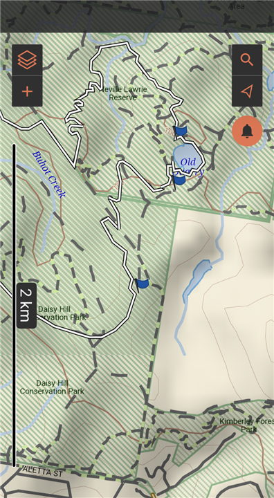
Yesterday I was hiking, following a course I created in Explore app. When I got to a certain point, the navigation line took me the wrong way.
I knew it was wrong, but wanted to see what it would do if I continued going the wrong way.
See the attached screenshot. At the point above the quarry where I have now placed a waypoint to clarify the issue, I should have continued up, but instead the nav line changed to join the path I had come from (waypoint 2) and then continued to route me heading back to the start of the hike via (waypoint 3) note these waypoints were not on the original course. They are only relevant to my question here.
So, can anyone explain this behaviour?
Also is it better if I want to follow a path I create prior to going on the hike, to use a 'course' created on the Explore app on my phone or to create a 'route' on the Explore website then sync it to the 66i (or a track perhaps) I haven't really got my head around the different uses of tracks, routes & courses.
My principal use is to research an area and design a route I want to hike or kayak on, using topo maps and then create that, sync it to the 66i and then be guided visually and audibly by the device from start to finish and have a record of the distance time etc for future reference. Including off course alerts.  Am I expecting too much from the unit?
Thanks for any help.


