I was wondering if the inaccuracy in the pic I attached is normal? This was created using Topo Active and snap to path turned on, showing a mountainous wilderness trail that supported snap to path.
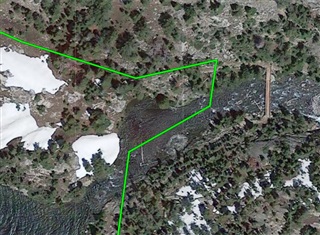
I was wondering if the inaccuracy in the pic I attached is normal? This was created using Topo Active and snap to path turned on, showing a mountainous wilderness trail that supported snap to path.

Seems odd...when I look at your Topoactive map photo, the course sits right on the trail line, though I guess you're stating that the trail line is wrong. On the Topo map, the course is not on the trail line because Topo doesn't support snap to path, yet the trail line is accurate?
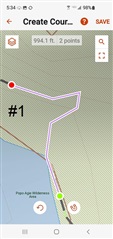
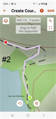
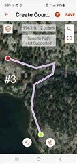
Thanks for your reply. I thought those previous images were correct at the time but they are not. After digging into it it some more I think I now know what the issue is.
Pic1 is TopoActive map with course created on android, trail on map is incorrect and snap to path followed it.
Pic2 is Topo North America map with trail placed correctly thus making the course off route.
Pic3 is Satellite with trail correct, course incorrect.
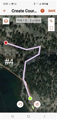
Pic4 is TopoActive w/Satellite with trail correct, course incorrect.
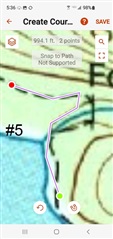
Pic5 is USGS Quad with USGS trail correct but course (and the trail it is on) incorrect.
I took the time to put this together so you could understand this and help others, just as you have helped me and many others also. Thank you! :-)
Very strange. I only use TopoActive routinely and have not encountered such errors. Maybe it's because I don't use Courses.
It sounds like had you defined your Course in another map (not TopoActive), it would have been fine.
But it also seems like if this were a widespread issue, many people who defined courses in Topoactive would be complaining about the problem. And that doesn't seem to be the case.
I think it is what JungleJim states, that " it's just that the Google Maps Terrain view is not very accurate" maps for mountainous terrain are commonly not very accurate. I don't have the issue at all when creating a course on highways and roads.
I would like to create the course using another map besides TopoActive but none of them support snap to path, the same reason I don't use routes on Explore Web. It's just to painstakingly slow and winds up having hundreds of points, trying to follow a say, 40 mile trail in mountain wilderness terrain.
Not a big deal because I am not using the Mini 2 to navigate, just to show my approximate intended route and communicate with family on MapShare.