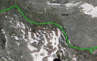
I was wondering if the inaccuracy in the pic I attached is normal? This was created using Topo Active and snap to path turned on, showing a mountainous wilderness trail that supported snap to path.
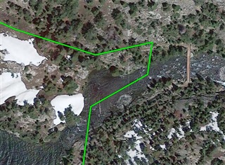
I was wondering if the inaccuracy in the pic I attached is normal? This was created using Topo Active and snap to path turned on, showing a mountainous wilderness trail that supported snap to path.

It's not just one spot, it is like that throughout the whole 36 mile course. I just figured extremely remote wilderness trails like this one do not have accurate mapping like a highway does. Any idea if it can be corrected in some way or another?
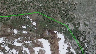
Mini 2 and android phone using Explore app to create new course using topo active and/or satellite with topo active with majority of it filled in using snap to path. But I don't see where the device has much to do with it does it? Appears to be in the software of the app I would think?
I don't have a Mini 2, I have a 66i.
I looked at the Mini 2 Owner's Manual and found this, "A course can have multiple destinations, and can be navigated point to point or on routable roads."
The Owner's Manual doesn't mention how one changes from "point to point" to "routable roads". It's not within the app.
It looks to me like the Mini 2 is setup to do point to point and what you want is routable roads (and paths). On the 66i, in the settings I can choose between direct path (point to point) and routable roads and paths.
You might have some kind of setting within the Mini 2 that allows you to make a change, though I didn't see it in the Owner's Manual. Check out whether you have that type of setting.
If I understand you correctly, you created a Course in Explore App and are viewing said Course in Explore Web with the Terrain map layer, right?
If so I think it's just that the Google Maps Terrain view is not very accurate. It's not uncommon for satellite imagery to be shifted compared to mapped terrain, especially for sloped or mountainous terrains.
Thank you L2H and JJ for the replies. I did create the course in Explore app, however upon viewing the course in either web or app, I have discovered that out of the map types I have installed on app, only the TopoActive displays properly/accurately, possibly because the course was created with that map view? At this point I would have to think you are correct JJ in saying the map is simply not accurate. But would that also apply to the aerial images being incorrect also?
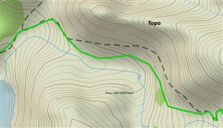
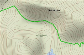
I don't usually use Courses, I use Tracks, and when I checked Topoactive versus Satellite on both the app and web, I saw no issues. I checked about six Tracks.
I created a Course on the app, and both layers were consistent. I synched it to web, and had consistent results there.
Topo and Topoactive were consistent on web. I haven't downloaded Topo on phone due to large file size.
I use an iPhone, not an Android, but I wouldn't think this is a source of the difference (not initially, anyway).
Did you check your routing choices on Mini 2 (if they exist)? It looks like part of the Course is already on your Map (dashed black line), so choose to use Roads and Paths.
You could also try to delete the Explore app, reboot your phone and then download the app again.
Hey. The issue is that TopoActive and TopoActive with satellite maps are wrong. The trail is shown on the map where the course in the above image is placed. The trail does't even align with the USGS quad maps. Kind of a poor attempt at making a map IMHO. The snap to path works and follows the trail but the maps are incorrect. Topo North America map is correct but doesn't support snap to path. No fix for that I am guessing so I will just have to create the course manually or use a different app and import. I doubt I will do that because I am not using the Mini 2 to navigate anyway. I much prefer using my eTrex SE and just entering a waypoint marker for critical landmarks and trail junctions. Way easier and simpler. Thanks for your input though, appreciated.