When will Garmin Explore include maps that are useful?

The maps in Garmin Explore are totally useless with lack of details. Users have been waiting for years for Garmin to add usable maps. They have outdoor watches, but their use is limited because official app does not have maps that can be used for outdoor activities. In many places (like in Finland) there are free topographic maps available, Garmin has to only add them to the Explore app. Or at least make it possible to users add those maps.

All other outdoor apps have better maps than Garmin, and after all Garmin has a very long history with GPS-systems and maps so it's a shame that they don't develop maps for Explore app so their users would get the best out of their watches.

  • Hello The mapping available in the Explore app is TopoActive mapping which is community developed mapping. This means it will have more detail in higher populated areas and less in less populated areas. Please see the description below. 

    TopoActive is a Garmin OpenStreetMap product. OpenStreetMap (OSM) is a community-developed mapping dataset, developed and added to by community mappers around the world. OSM is a highly detailed dataset. In many rural areas of the world, OSM has medium to low-detailed data. Features are added and edited by community members with local knowledge. Coverage of features may vary and includes geographic locations, place names, landmarks, points of interest, hydrographic features, and land-use/land-cover. OSM is an open data source. OSM also includes an open data source elevation dataset. Because the OpenStreetMap data is Volunteered Geographic Information, scale detail is not consistent. Scale detail can vary from 1:24,000 or better in major urban areas to 1:1,000,000 in more rural areas.

  • Like said, Garmin maps do not include enough details for route planning or hiking. At least this is the issue in Finland and in many other European country.

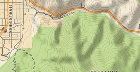
    Here is an example of four different maps from the same place. Garmin is top left. As you can see, all the others have details, Garmin does not. How can you rely on a map like that? For example it does not show cliffs or rivers. If you plan your route without that kind of information then there will be problems...

  • What's even more frustrating is that I used to do all of what you are talking about in Basecamp, which has hundreds of maps both Garmin and opensource available. Setup the route with shaping points, alert points, turnabouts, halfway markers, etc. Then sync that to a decades old technology device and have ALL of the info I wanted and more available on the trail like how far to the next point, how far to the turn, how far to finish, times to each, etc. AND I could still upload tracks to the social platform if I so chose. Now I have a decades newer technology device that will take the route from Basecamp but it has to be less than 200 points TOTAL, alerts for EVERY point even though I've set them to shaping/no alert and is useless for anything other than telling how far/long until destination. Now I'm relegated to pulling Alltrails into Connect and then syncing to the device and Explore, which is worthless for anything other than point A to end navigation or import it into basecamp, covert it and have it beeping and buzzing every 50 feet. Additionally, imported into Basecamp routes that are sync'd via the device don't show up properly in Explore (those from Connect either) even though they are showing on the device. I've got 2% of the features in this new device than I had in a device from 2011 and 3 times the cost. It would have been better to make the device not have any features other than point A to end navigation, remove 3/4 of the electronics, save the battery life and charge 1/3 of the price. Less features than a 13 year old device and 3 times the cost. Sounds about right. It's not about navigation and tracking anymore, (Basecamp) it's about socializing that I was out walking in the woods. (Explore) Sad...