Please bear with me, I feel like terminology may be part of why I've had trouble searching this topic.
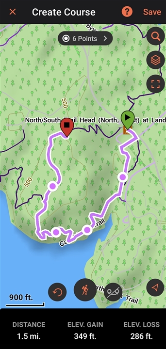
I LOVE the feature in the Explore App that lets me use the base mapping to create a course and then follow it on my Epix. The tap interface to draw a route that snaps to trails is great. Best interface I've seen for this type of routing.
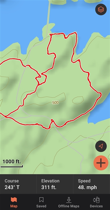
Only problem is a lot of my favorite places to hike are not mapped into Garmins Basemap.One local state park has a network of trails, and from one trip to the next I may want to mix and match trails to keep it interesting, since they loop and connect in various ways.
Well, I can make that not a problem, I just need a track. I can get tracks all day, either from my previous activites, or import KMZ.KML, GPX. I work in mapping so I know how to manipulate that data somewhat.
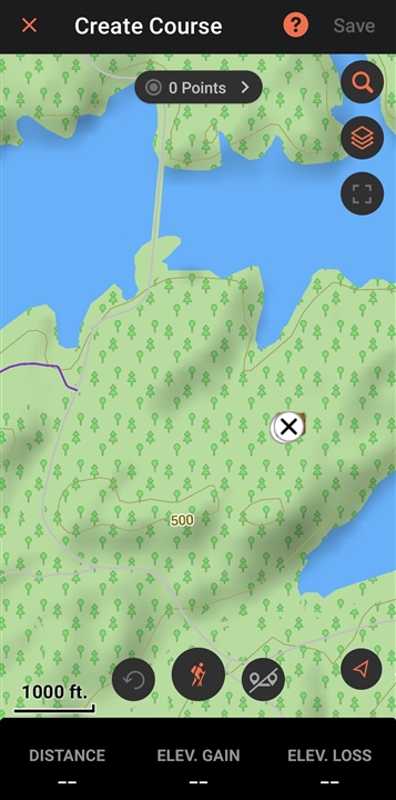
My issue, either ignorance on how to do it, or maybe this is a feature request, is I'd love for this user saved data to be visible in the course create editor so I can pick my own path in the app like you can for the base mapping. When I go into the interface to draw my snapped to trails course, I cannot see my saved data on that screen, just Garmin basemapping. And using Explore, filtering like just showing the desired collection would keep this from being a mess.
Now I can and have simply edited the data to make it a continuous track in the configuration I want, convert that to a course, and go. But it's kind of a pain to have to drag out the GIS software to edit the data in the configuration I want, when I know the interface in Explore is capable, if I could just trace over my existing tracks. That tap interface even lets you fix gaps, so it doesn't even need to be perfect.
Any ideas? Thank you.