This discussion has been locked.
You can no longer post new replies to this discussion. If you have a question you can start a new discussion

[MAP VIEW] alternatives to open street maps

hello everybody,

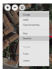
is there any option to make the map view better? I'm not really satisfied with the Open Street Maps, there are lots of mountain peaks and trails missing.
A similar map like in Strava would be nice. Anybody know if there is a improvement possible or even planned by Garmin?

I can't be the one who think that this maps are terrible e.g. for planning a route.

Please like this post if you want to improve this too, maybe someone of the Garmin guys is reading this!

BR,
Chris

  • Original OSM is quite good, mapped trail paths have rather better accuracy then on other maps and there are few styles, but indeed, some areas are not mapped yet. You can register there and add missing paths basing on your GPS with corrections using relief-map and photo-map.

    Though, it will be updated almost instantly on original OSM, but to get it to the Connect's copy it will take a long time, and there is only one simple map's style here, so that's true it's a worse version.

    With all users' activities they could make some better heat-map which would be useful to choose routes. Currently they just use OSM's paths and add color to frequently used ones, so missing paths won't show on the heat-map no matter how popular.

  • in my area OSM are not very good, there are lots of ways missing especially no trails are shown. So I can't plan any routes with my Fenix. 
    Even Suunto has a much better map view. For a premium reseller like Garmin there should be at least a opportunity to choose such a detailled maps for those who live in the alps. 

    Please Garmin do it!! And also name the peaks of the mountains.. 

  • You have several options. Besides the OSM maps, you can also chose Google Maps and HERE maps. Then you can switch between the map and satellite views, and enable or disable terrain, tracks, and labels:

  • I know, thank you. But there are lots of ways missing in my area.. And almost none of the peaks are named. If you wanna plan a route you have to do it free. Like I mentioned before, even Suunto have good maps. 

  • You can plan a route with a 3rd party app, if the options in GC are not sufficient. I do sometimes use plotaroute.com, which has the advantage that you can export the tracks in Garmin's native FIT file format.

  • The maps at Garmin Connect are not good at all. I wonder why the updates takes so long time. It should be an automated process since it is something that needs to be done as often as possible. For a start it would be good with at least once a year, but more often is of course better.

    I use Strava for all my route planning. Pretty much the only reason why I have a Strava subscription.