


I'm analyzing a track of a race I'll do next Sunday.
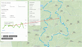
Moving the mouse over the altitude diagram, I can check where this position is on the map.
Moving the mouse over a point on the map, I can't check the altitude of this point in the altitude diagram.
I think it may be a great new feature, similar to the onthegomap.com.
Thank you!
