Hi,
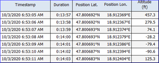
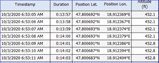
So my Instinct took some incorrect measurements at one point, probably the sensor was blocked...altitude dropped suddenly to -22 meters.
In total I have a number of waypoints with incorrect altitude stamps, how could I correct that? I have the correct data more or less from the topo maps.
Thanks,
Adam