This discussion has been locked.
You can no longer post new replies to this discussion. If you have a question you can start a new discussion

Errors in Garmin Connect maps

Hi,

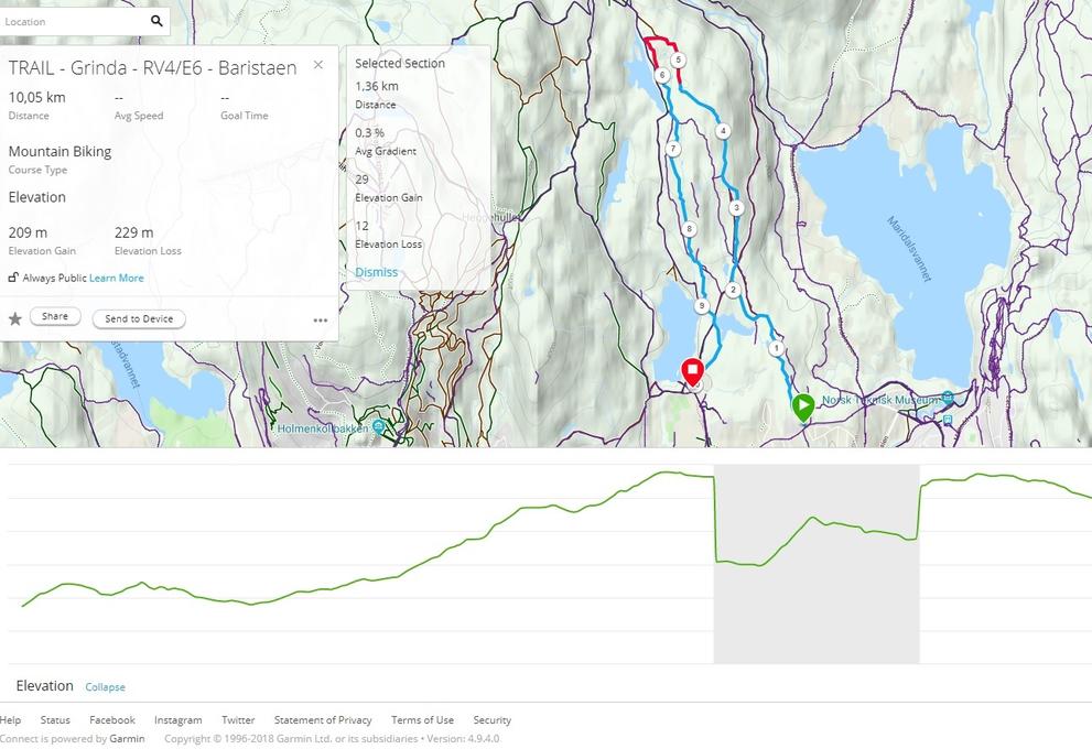
Created a course in Garmin Connect , but there is an error with elevation data. There is a steep elevation loss and gain on the route I have created that I can confirm does not represent the true topgraphy. Just have a look at the screenshot from Garmin Connect.

How do I report this error and to whom?

Thanks. ciq.forums.garmin.com/.../1402533.jpg
  • When you create a course in Garmin Connect, you can select map provider, by expanding the list in the upper right corner. So if you want to get it fixed, you should contact the map provider.
  • Those elevations are detected via satellite radar systems and recorded in a digital elevation model (DEM). I am not aware of how to report a DEM error.
  • ok. I went back to the course, put 2 waypoints outside the area that causes errors. Then I tried with all 3 maps and with follow road and popularity routing to redo the course creation by moving one of the waipoints along the course. The dip in elevation remains... But all maps option created a similar route. Looks like they all use the same source data in terms of topography. :)
  • Looks like they all use the same source data in terms of topography. :)


    This is quite possible. But it is also possible that Garmin Connect utilises a separate DEM layer, independent of the selected map.
  • Many digital systems use the same ellipsoid for the approximating the world ... WGS84 ...most times this is fine but in some areas this can be out by a lot. In the UK the Ordnance Survey use a different ellipsoid for approximating the earth around the British Isles. This is also backed up by the fact that Oslo has one of the highest recorded gravity g ... related to the high radius of the earth there ...
  • Ellipsoid shape is not the same as DEM data. And certainly does not explain the issue described here.