This discussion has been locked.
You can no longer post new replies to this discussion. If you have a question you can start a new discussion

Garmin Appalachian Trail map is Non-continuous.

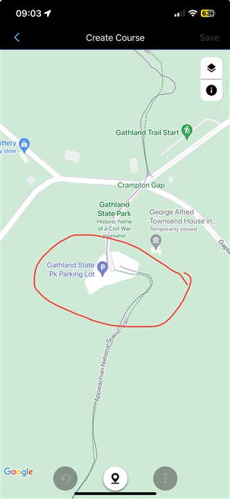
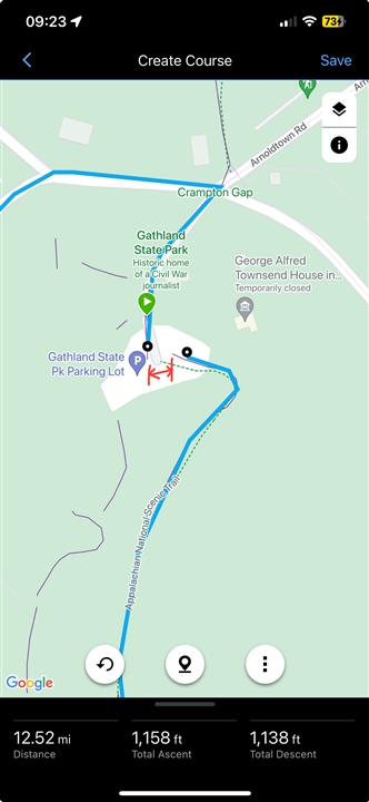
This echoes a post I saw from 2 years ago, but I didn't see a resolution and I just had the same problem. Essentially, the AT trail data is non- continuous/broken at various points. End result is a circuitous rerouting using roads, etc, instead of linking those two parts of trail that are only meters apart. For instance, in Gathland State Park in Maryland, the purple lines are not connected. Trying to make a custom route creates a 12.5 mile journey to access the southern end of the trail and go north, as opposed to linking the two navigation dots that are only meters apart. 
See photos below. (OP was referencing same problem in Tennessee, two years ago.)

 How can this be fixed? 

Top Replies

All Replies

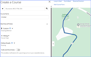
  • Using Garmin Connect Web with routing set to "follow roads" I was able to navigate this section of the trail. 

    Using the web interface, you can easily switch between using the popularity heat map (follow popular routes), follow roads, and freehand. This way you can navagite virtually anything and in some cases might need to switch to freehand routing where there is no trail or road at all, such as bushwacking. 

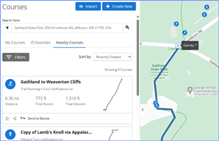
    Another option using the web interface is taking advantage of the "nearby courses" feature, which allows you to view and copy to your own profile, courses of other Garmin users that have already created the same course and made it public.

    Many of these options are not available in the Garmin Connect Mobile app.

  • Interesting.
    I created that as a Custom course using the Connect Mobile App. To be honest, I didn’t even really know there was a Web interface - because in order to access your most common data on your most common device you’ve got to download the app…and so why would I (anyone?) go looking for anything else? 

    So we are saying this a platform issue? 
    Works on Connect Web/doesn’t on Connect Mobile? 

    I suppose that’s a solution, just not super graceful or completely user friendly. For instance the AT poster I referenced was doing daily route planning sessions on their thru-hike. 

    I truly hope this is something Garmin is working on correcting, given the prevalence of mobile devices and decline of all other forms. 

    Either way, thanks for the speedy (and accurate) response. Now I know. 

  • So we are saying this a platform issue? 
    Works on Connect Web/doesn’t on Connect Mobile? 

    That is correct. There are a few features on the web interface, not just related to course creation, that do not exist on the app. I have to say that for course planning I much prefer the web on a large monitor, especially for course locations that are new to me. Might be an indication of my advanced age, or just easier to use in general.