This discussion has been locked.
You can no longer post new replies to this discussion. If you have a question you can start a new discussion

ATTENTION GARMIN OREGON 550 OWNERS! Help! I may have "killed" my Garmin Oregon 550!

Hey!

I will freely admit, right at the start, that I did something rash and stupid and destructive. I am a complete fool and in serious need of some kind soul's help.

It all started with my having a problem installing the newest update, Garmin City Navigator North America NT 2024.20. I could not seem to get rid of the existing Garmin City Navigator North America NT 2024.10 because it did not show up in MapInstall, probably because I had, at some point, uninstalled the map from my computer.

That was Strike One.

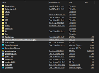
Strike Two was that, in searching for the ".img" file on the Garmin Oregon 550, I mistakenly accessed the root directory of the device and deleted a different ".img file from the "Garmin" directory of the internal storage of the device, whose name I do not completely recall but was something like "gmapsupp.img" or something vaguely similar, with a file size of about 50,500 kB.

Okay, that was more likely Strikes Two AND Three. In any case, I was out of luck and now my Garmin Oregon 550 will boot to a blank map and a locater icon with a question mark.

I am asking for someone with an old Garmin Oregon 550 laying about to find the file that I am missing (There are only two .img files in the "Garmin" directory off the root directory of the Garmin, the other being the "gmaptz.img" file that represents the time zone data.) and copy it, making it available to me so that I may replace it and, hopefully, get my device running again.

I realize that this is a big ask, but this unit is a godsend to me and, at today's prices (And my fixed senior's income!), there is no way that I can afford to replace it.

I thank you, in advance, for whatever assistance you may be able to provide.

  • The very first thing that I do on with a new PC or a new installation of Windows is to configure Windows File Explorer to my liking and this includes ALWAYS setting "Show Hidden Files, Folders".

    Good call, just not a consideration in this case.

    Still, I appreciate the input. It means people are still thinking about this problem.

  • Well he says they appear in Explorer but aren't seen by the device so I'm not sure that's the issue.

    MapInstall doesn't tell your device anything, it simply sends what it's asked to send to your device. If there are valid maps there your device will display them.

    If you are sure the maps have been sent, and if they have then the date/time stamps of the files will make sense, then the problem isn't with MapInstall. What's the name of the folder containing the maps on the card? Can you post a screenshot showing the files MapInstall has placed in the folder?

  • See my post above. You could also try running JaVaWa's Device Manager and see what it says about maps on your device and card.

    www.javawa.nl/jdm_en.html

  • That I can do.

    I have just formatted the microSD card and am in the process of using MapInstall to transfer the TOPO Canada v4 map to the Oregon 550. But, as soon as this is done, I will screenshot the contents of the "Garmin" folder on the mSD card. This folder is at the root of the mSD card.

  • Formatted as FAT32 I hope.

  • Yes. WIndows 10 seems to default to this for the 32 GB card.

  • One other thought as I wait for the screen shot.

    Your Oregon is limited to accessing a total of about 4,000 map tiles.


    Maps are broken down into smaller tiles, and the 4,000 limit is calculated by the total of ALL maps installed on your GPS, including internal memory and the memory card. It doesn't matter whether or not they are enabled.  If you exceed the limit, some maps won't work properly or won't show up at all. Impossible to be more specific, it depends on your exact mix of map files.

  • Okay. MapInstall says that it completed the transfer successfully.

    Here are screenshots of the "Garmin" folder on Internal Storage;

    And of the "Garmin" folder on the microSD card in the device;

    And, finally, of the details of the Setup > Map > Map information Select Map screen;

    And there you have it. I have been getting this over and over and over again every time with the same results (Definition of "insanity", am I right?).

  • OK, now run Device Manager that I linked to above. Does it show the map? If it does towards the top it will tell you how many map tiles are in the maps, what is that number?

  • Even though the Topo is unlocked, the GPS may still be looking for the .unl file that is normally on a mSD card when the map is bought new.  I admire your tenacity!  How about installing a 3rd party topo - like the one from Alternatives - and just select your area local using MapInstall to load that to the card.  The transfer time will be much reduced and you'll see if the GPS can now 'see' the new topo map.  The Canada Topo v4 is 1,225 tiles but is over 4GB in size.  Map limits here: https://www.gpsrchive.com/Oregon%20x00/Maps.html#FAQ-M20.)%20What%20is%20the%20maximum%20map%20file%20size%20supported%20by%20the%20Garmin%20Oregon?