Hi everybody,
I have the Garmin Zumo 350 (motorcycle sat nav) and I am planning to use it on a trip around Europe this summer. So, I have downloaded the basecamp software to customise my route. However, I'm getting really confused on adding stop over points to the point where I'm bashing my head against the wall.
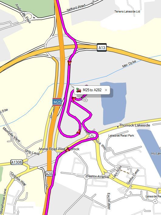
Basically what I want to do, is to add a service station just over half way along my route for filling the bike's fuel tank up (thurrock M25 service station) and get back onto the M25 then eventually the M20 to Dover. When I add Thurrock as a waypoint, it changes the route completely. It changes the route from my starting point and takes a longer way round to the M25 orbital then takes a different route again to Dover from Thurrock.
The services can be accessed by exiting the M25 at a certain junction (don't know what the Americans call that, intersection maybe?) then exiting and going back on the M25, but the software completely deviates from that!
How can this be solved? Sorry if this is a half-arsed attempt to explain it.
Robbie