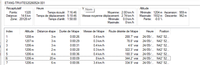
It's not described in garmin documentation, but it's seem it's the only explanation to the value de <gpxtrkx:Distance> attribute of gpx track by garmin using Garmin64S.
See under a sample:
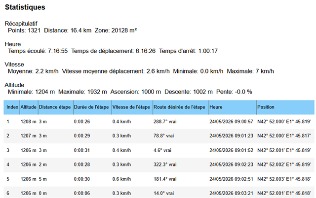
It's not described in garmin documentation, but it's seem it's the only explanation to the value de <gpxtrkx:Distance> attribute of gpx track by garmin using Garmin64S.
See under a sample:
…In basecamp, make a duplicate of this track. In the properties window select and delete point 6. This will force a recalculation of the statistics and they will be based on the track log.
The track log recorded 1320 points. The trip computer used over 26,000 points (it determines a position in 1 second intervals).
GNSS does not give a true position. The direction and magnitude of error…