Hello all!
Looking to gather some advice regarding map projection and line projection on Garmin Basecamp.
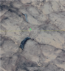
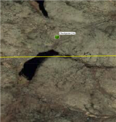
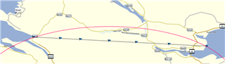
I have a line of 2 points drawn on Google Earth which uses a sphere projection (I believe) from one side of the UK to the other as pictured below.

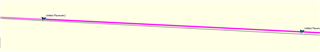
However, when input onto Garmin Basecamp which uses a flat projection (I believe) some key parts along the line because drastically different. (these are most noticeable towards the centre of the line which has about a 100 metre difference south from my google earth line).
My questions are as follows
1. Is there any way to use a similar view on Basecamp as is available on Google Earth that accounts for the earths curvature?
2. When it comes to following this path which software should I use as a good reference for what I will come up against? Google Earth shows me avoiding various water bodies but on Basecamp I end up going through them according to the line on there.
Looking forward to learning more
Thanks in advance