Map install to PC of CN NA NT 2023.20 seems weird.

These may be a Basecamp questions but they have to do with a map install so I am posting here first. 

1.  I have an XT that contains the CN NA NT 2023.20 maps as All US and All Canada & Mexico.  The maps have been installed on my PC.  In Basecamp, with the device connected, there are two maps listed as "City Navigator North America NT 2023.20 (zumo XT)" and of course there is one "City Navigator North America NT 2023.20 (installed)"   Both of the ones containing "zumo XT" appear to display the same map.  Why doesn't each one only show its own region and is there a way to tell which is which?

2.  Should I be concerned about the difference in map displays (see below) between the installed and zumo versions, specifically when zoomed out fully?   Image 1 is the installed version,  Image 2 is one of the zumo versions.

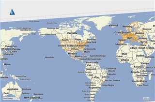
Image 1:  City Navigator North America NT 2023.20 (zumo XT)

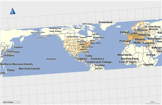
Image 2:  City Navigator North America NT 2023.20 (installed)

  • 1) Zoom to street level (say 1 mile scale for medium detail) and switch between the two maps.  The one that gives the most detail is for that region (either US or Canada/Mexico).

    2) Only if you plan on traveling above the artic circle to one of the islands that a part of Canada.  If so, be sure to use Zumo map.  But, there aren't many settlements or roads (if any) that far north.

    I noticed you map is not align to true north.  If this is unintentional, you can hover the cursor over the blue arrow in the upper left and then click on the N on the compass rose when it appears.

  • It still seems weird to me that the installed map does not show anything below the equator (approx).while the XT map does, even though the XT map is in two files.  Everything seems to be working fine so I'm not going to worry about it.  I just thought it was odd.

    BTW, I realized the need to set north up after I took the screen ships.  I had singular focus on the map display difference.

  • BaseCamp has a separate Global map.  I'm don't know if devices come with a global map, so it may be incorparated into the Navigator maps when downloaded to a device. Or maybe the device has a global map that can't be disabled but their tiles only become visible at higher zoom levels (devices differ from BaseCamp in that they can have multiple maps enabled at the same time).

    The detail, POI's and ability to create automated routes only work in the area of coverage.  You should only be concerned if part of the coverage area is missing - with the possible exception of the extreme north of Canada.

  • It still seems weird to me that the installed map does not show anything below the equator (approx).while the XT map does, even though the XT map is in two files.

    The screen shots are of the global basemap.

    Zoom in more (a lot more) to pick up the detailed maps.

  • The screen shots are of the global basemap.

    Nope!  The narrow one is CN NA NT 2023.20, zoomed all of the way out.  The other one is the same map from a connected XT, fully zoomed out.  So far there is no explanation for why they display differently like this.  Functionality is fine  It is just the display oddity that I was hoping someone had an explanation for.

  • The CN NA map doesn't have detail for Asia or Europe. So, there has to be detailed information as well as the information (which doesn't have detail) you are seeing for other regions when zoomed out.

    What you are seeing in the screenshots is some form of global map, which is being included in the map file you select.

    --------------------------------------

    I have the "Garmin Cycle Maps".

    These are split as "Amer, North" and "Amer, Central".

    California, Nevada, Arizona, New Mexico, Texas are in the "Amer, Central" (as well as Central America).

    These both show North and South America (and Antarctica) when zoomed out but no detail outside their region when sufficiently zoomed in).

    When zoomed out, there's a light blue outline of the region covered by the detailed map (at least for the Cycle Maps I have).

    --------------------------------------

    The map files contain "tiles" (which are squares on the map). There can be different sets of tiles for different zoom levels.

    One reason it's done this way is that rendering (drawing) detailed tiles at zoomed-out levels would be slow. So, zoomed-out, BaseCamp draws larger tiles with much less detail.