There are some older threads with similar but not same content. So I need to ask here.
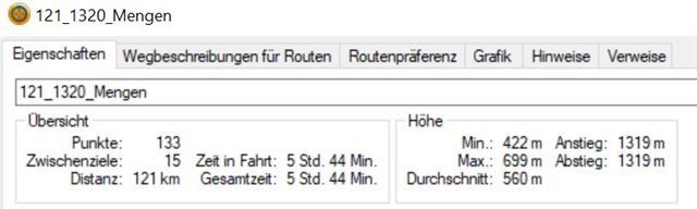
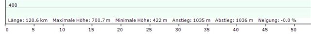
When I create a route in BC I get an information aout the length and the altitude gain at the bottom of the map. HOwever when I open the graphic elevation profile and measure the between he start and the end point I get a different number of the total elevation. If I convert the route to a track, which I normally do, then the elevation info is the same as at the bottom of the map. Most times however I found the the elevation profile information of the route is more accurate and matches the climb altitude of the ride itself. I use the "Velomap" together with the adequate contour lines. But this can't explain the difference in BC. Example see below.