Distance and angle from one waypoint to another waypoint in Basecamp are not the same as in Google Earth.

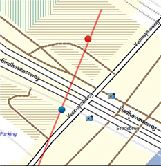
Being on one location A, and need to go to another location B, where distance is about 2,1 km and angle is about 20 degrees.

The results in Basecamp are 48 meter off from Google Earth's results.

There are internet sites where you can do these calculations, and the results are the same as Google Earth. I tend to believe Google Earth.

What could be wrong in Basecamp? Settings?

BR, Marko

  • Under the menu Edit>Options select Measurement.  In the Position box, what are your settings for Grid and Datum?

  • No strange things:
    Lat/Lon hddd° mm.mmm'
    WGS 84

  • BaseCamp should not differ by 42m with that setting.  How are you obtaining the distance in BaseCamp? Can you provide the Lat/Lon of your two points and the version of BaseCamp you are using?

  • My WP1 = N51° 21.107' E6° 08.925'

    The distance to WP2 is 2131 meter, the angle is 21,0 degrees from North.

    Basecamp:

    You can use 'Create track' from WP1 to the point where the distance just switches from 2,1 to 2,2 (under an angle of 21,0 degrees in this case). You can see the data in de bar at the bottom. This switching point is important, because Basecamp does not show more than one digit for the hundred meters.

    Then you create another track from this end-point, 69 meters back on the first track. You can now see the number of meters in the data bar at the bottom. You should end up at WP2 in my view. I get to N51° 22.155' E6° 09.570'

    Google Earth:

    Measuring on Google Earth from WP1 the same distance and the same angle, Google results in N  51°22'10.74" E 6° 9'35.04" which translates in Basecamp to N51° 22.179' E6° 09.584'

    If you use the website https://www.geocachingtoolbox.com/index.php?lang=en&page=coordinateProjection then you will get N51° 22.179' E006° 09.584' which is the same as Google Earth's results.

    I'm using Basecamp version 4.7.4 on Windows 10, and I'm using this program already for ages Slight smile

  • Trying other things I noticed this:

    If I create a track with points in between, just 999 meter each, I get to the WP that Google Earth and this website are providing. Do I make a mistake with my interpretation of the switching point from 2,1 to 2,2 km?

  • Thanks for the information.  I'll take a look at it later today and post a reply.

  • I’m not sure how you came up with N51° 22.179' E6° 09.584' for the coordinates 2100m, 21° from the provided waypoint 1.  I get N51° 22.164' E6° 09.573' from both google earth and the projecting a point using the link you provided.

    Sorry the reply took so long, but it took a while to figure out the type of calculation (great ellipse, great circle or rhumb line) and whether BaseCamp was rounding or truncating values.

    BaseCamp, Google Earth and the link you provided are doing a great ellipse calculation.  Distances shown in the bar at the bottom of BaseCamp appear to be doing basic rounding.  Oddly, the angle appeared to be truncating (based on a quick test, so I could be wrong).

    Starting from N51° 21.107' E6° 08.925' using the track tool at maximum zoom, I placed a point where the distance changed from 2.1km to 2.2m and the angle changed from 20.9° to 21°.   I followed the line back 50m to mark the final point.  The coordinates of the last point were N51° 22.164' E6° 09.573' – the same as I got in Google Earth and the link you provided.

    I did notice, when zoomed all the way in, that multiple cursor positions gave the same displayed value in the lower bar.  BaseCamp may be storing a slightly different values then what is seen in the lower bar.

    For anyone unaware, a rhumb line follows a constant course – a great circle and a great ellipse arc toward the nearest pole, so the course is constantly changing along the path.

  • Thanks for the detailed analysis in your reply.

    Google results in N  51°22'10.74" E 6° 9'35.04" which translates in Basecamp to N51° 22.179' E6° 09.584' " ==> What I do is create a WP in BC and I copy/paste the GE numbers in the WP in BC. BC translates automatically. BTW, distance is 2131m, not 2100m. Maybe that explains the difference?

    Let me give some pictures on how I did it.

    1) starting at WP1 create a track (red in the Picture 1 and Picture 2) to the point where distance changes from 2,1 to 2,2 and where angle changes from 20,9 to 21. (I think you were doing the same)

    2) starting at the end point of the red track, I go back 69m (track "Venlo 69 meters back", green in the Picture 3), This provides the WP "Venlo WP2 drawn".

    This is not the same as what GE/the site provides (in the picture "Venlo calcuclated/GE").

    I'm reading from your reply that you don't get a difference between BC and GE/the site. This I don't understand.

    Seems I cannot attach pictures, hence captured on youtube Sweat smile

    Picture 1:

    Picture 2:

    Picture 3:

  • You have me confused on what you are doing.  In BasCamp we are both starting a track at N51° 21.107' E6° 08.925' correct?  We are both creating a track point when the bottom bar changes from 2.1km to 2.2km and 20.9° to 21.0° correct?

    If BaseCamp rounds the distance and truncates the angle this point must be assumed to be 2150m from the first point at an angle of 21.0°.  We both backtrack  on the route to create the final point.  If the distance in google earth is 2100m, then I must backtrack 50m.  If the distance in google earth is 2131m, then I must backtrack 19m.

    If I make the last track point at 2100m (moving back 50m) I get N51° 22.164' E6° 09.573' which is what I saw using the measure tool in google earth and starting from the initial coordinates, moving out to 2100 and an angle of 21.00°.

    If I take my track in BaseCamp and change the last point so that is 19m from the 2.2m 21 ° point (making the distance 2131m from the start),  I get N51° 22.180' E6° 9.583'.

    This differs from N51° 22.179' E6° 9.584' by ~2.2m.  This seems an acceptable result given the slop in placing a point in BaseCamp..

    For what it is worth, by track point in BaseCamp when the lower bar switches to 2.2km 21° is N51° 22.189' E6° 9.589'..

  • In BasCamp we are both starting a track at N51° 21.107' E6° 08.925' correct? ==> Yes

    We are both creating a track point when the bottom bar changes from 2.1km to 2.2km and 20.9° to 21.0° correct? ==> Yes

    If BaseCamp rounds the distance and truncates the angle this point must be assumed to be 2150m from the first point at an angle of 21.0°. ==> Right, so here is the misunderstanding on what BC does. It does not change at 2199m to 2200m, but it rounds. Hence the end point of the track is at 2150m, and I need to backtrack 19m from there to get at 2131m.

    We both backtrack on the route to create the final point.  ==> Correct.

    If the distance in google earth is 2100m, then I must backtrack 50m. ==> You mean 2200m? So that with 50m backtrack you end up at 2150m?

    If the distance in google earth is 2131m, then I must backtrack 19m. ==> Back from the 2150 I guess.

    I think I understand the other statements you made.