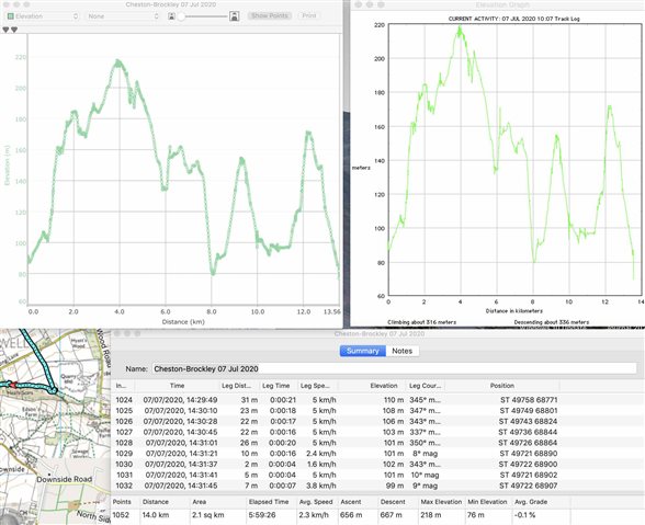
This is the elevation plot of a track recorded by a GPSMAP 66s. The left-hand plot is from Basecamp, and the listing (below) gives 656m of ascent. However, just eyeballing the elevation plot shows that it is an exaggeration, and another app (MacGPS Pro - see right-hand plot) gives only 316 m of climbing, which is much more believable. Can anyone explain this?