This discussion has been locked.
You can no longer post new replies to this discussion. If you have a question you can start a new discussion

While navigating a saved route my 1030 screen keeps showing tiny segments instead of allowing me to stay with my main activity profile.

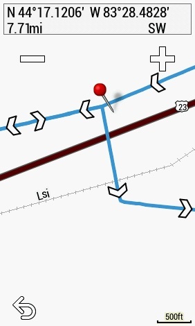
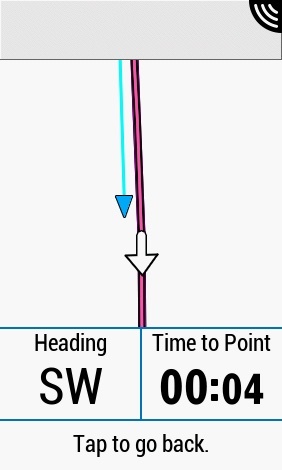
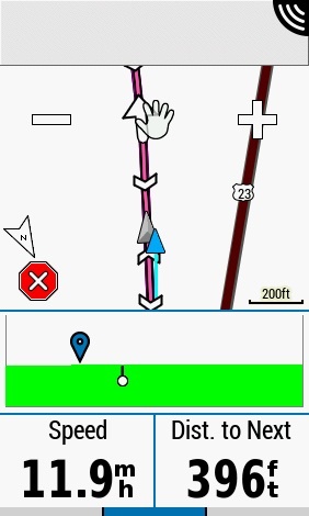
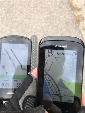
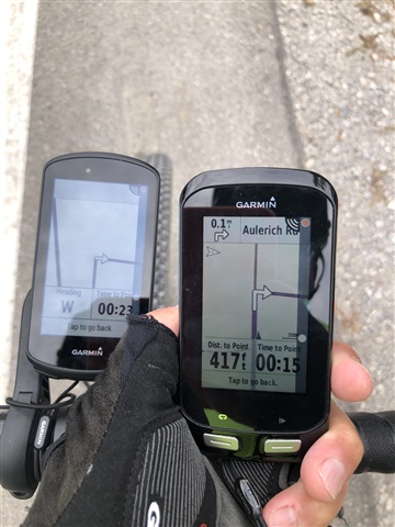
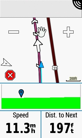
I want to stay with my data fields except for turns or when I want to study the map.   Instead, my 1030 keeps reverting to short increments on the route that are useless.   I can tap the screen and it goes back to the data fields and then shortly it reverts to  these small segments.   Have gone through all of the settings and nothing seems to affect this.   This is happening on fit files downloaded from Ride with GPS.

  • I just checked, and it was off for Gravel.  I have made so many changes in the last few days, I have to go through them all.  I hope this does it.  Thank you much!!

  • I still don't get the black line.  Thanks.

  • I don't get the black bar either.

    I do know the 1030 works fine with courses.

  • OK, rode a course yesterday that I had ridden before.  All started out normally, with turn prompts, as I had selected.  The course goes out apx 50 miles, but comes back on itself. at some point  Never had an issue before, but yesterday, early in the ride, as soon as I passed the road that turns towards the finish, it started doing the reverse/arrow pointing towards me deal, with the constant multiple segments.  It wanted me to turn down that road, instead of pressing on with the course.  I wasn't smart enough to take a screenshot, as it pissed me off, and I stopped the navigation. So why would it do that.  It has never done that before.  I will include a screenshot of the course and turn point where it happened.

  • That happens once in a while. Basically, the unit thinks you are turning around (shortening your ride). One thing that causes it is when the unit loses track of the correct heading.

    I think the likelihood of this happening is higher if you stop on such a segment.

    If you keep riding in the right direction, it should sort itself out.

    You can also reload the route. This will work better if you are moving in the right direction as it calculates.

  • OK, just did a ride, and used both the 1030 and the 1000.  The 1000 worked as advertised, and also showed me, and the course, on the road that I planned it on, through GC.  Another words, the GPS was also working as advertised.  The 1030 did what it had been doing, although, it did provide the pre-turn arrow, as did the 1000.  Pictures to follow.  After I passed the turn that I showed a pic of in the previous reply, the 1000 pressed on as it should, continuing along the course.  The 1030 immediately started with the arrow pointing towards me, another words, the wrong way.  So I stopped navigation on the 1030, then re-entered the course, and it went forward in the right direction.  Except now it did the CONSTANT displaying of the course and arrow, and showing seconds to go.  When I would tap it to go back to data, it would immediately go back to the map.  I finally stopped course nav for the duration of the ride, on the 1030.  The 1000 worked as it should.  So between those anomalies, and showing my position well off the course/entered road, something is wrong with the unit.  Now what to do.

    Notice how far off course the 1030 position marker is.

  • The first and second picture are both showing the same heading (SW). The map is rotated but it's showing the same (basic) heading.

    The second picture shows a "false" turn (where the white arrow is). This could be a change in the name of the street.

    I don't know what you are trying to show in the third picture. The zoom levels appear to be different (300 ft in the left; 800 ft in the right).

    You can turn off the elevation profile (the green thing). I don't find it very useful.

    Not sure what you mean by "position marker". You should probably display the same data on each. It would be interesting to see what the "Dist to Point" is on the 1030.

    If you are talking about a particular course, you need to provide a link to the course.

    and showing my position well off the course/entered road

    This could be that the placement of the road isn't exact (not that uncommon). It could be an inaccuracy in the GPS reading. Are you using Glonass/Galileo

  • Turn on Lock on road to make the marker be placed on the road. I got it turned on in the Road profile and turned off in MTB. 

    Which setting do you have in the Edge 1000?

    https://www8.garmin.com/manuals/webhelp/edge1030/EN-US/GUID-75D72D8E-4D22-41E2-A11A-15250A9CC91D.html

  • The "lock on road" option just forces displaying the cursor on the nearest road. It doesn't change the data (the recorded track).

    That option appears to be more intended for driving.

    I'd rather have the cursor show where the unit thinks I am. Since you can see if you are on or off a road, the "lock on road" isn't adding any information.

  • Lock on road was off on both.  I don't remember the 1030 being that much off course before.  The 1000 is dead on.  Both on GPS/GLONASS.

    Why it is turning, instead of navigating straight ahead, I don't get.  It is doing it consistently now. And with the constant pop up of the map page, it is unusable.  I know this route, but if a load one in an unfamiliar place, it wouldn't be able to navigate it.