This discussion has been locked.
You can no longer post new replies to this discussion. If you have a question you can start a new discussion

Not ready for prime-time-MTB navigation

I've started this discussion about the many frustrations I have with the 830, and hoping some of them were just user-error, since the device is new to me (had a 520+ before it). However, the one MAIN function, NOT feature, a GPS device is for is to, well, navigate someone along a course.

I've tried, and tried, and tried, but have learned that the 830, and perhaps any device like it regardless of brand/model, is just NOT good for trail navigation. I've tried creating (Trailforks) routes with start/stop points at least 200 feet from each other, start navigation 200+ feet into the course, blah, blah - NADA!

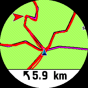
I just can't make it tell me to take the correct fork in the trail. I can't make it 'navigate" on a trail.

(sigh)

Thanks for all the help in the other discussion (linked above).

  • I find the device's success at navigation is reliant on the map data.  I've ridden in areas where mtb navigation was useless and other areas where it worked well.   Dense trail systems with map errors are bad.  More open trail systems with solid map data work fine. Typically for me it's been the northeast US for the former and  the west for the latter. For mtbing in dense trails and where map data is incomplete or inaccurate, I'll  just display the track on the map and follow it without using the device's navigation. 

  • Trailforks maps, which I use, supposedly have good map data, at least for the trails I ride. Trailforks trails are created using uploaded GPX files. (I created a short connector trail and I needed to upload a GPX file for it.)

  • Absolutely. Look at the mess (which is the same on my fenix6).

    So I should turn somewhere left in 5.9Km. 

    I just have no clue where to turn right now Slight smile

    The only explanation for this I can imagine is that at Garmin absolute noone with any say rides an MTB.

    I would laugh at anyone who bought this joke for 700 bucks. Just that it was myself Disappointed

    ...and this has nothing to do with maps. Even without any map you could make this 999 times better by drawing a stupid arrow towards the next segment at any course crossing

  • Uploaded GPX files just provide the track.  They don't provide the way properties, intersection properties, and other data used for navigation.  For example, you can look at the track from one of your rides.  It is a continuous squiggly line that does not show if there were intersections, whether the turns you made were kinks in the trail, or a turn at an intersection, the trail changed to a road, you went through a parking lot, or anything else.  All that information has to be added to the map database to make it useful for navigation.

  • Fair point. But the Forksight feature, which works well on my trails, seem to indicate the the device is “trail-aware” though.

  • I've never been able to get Forksight to do anything.  Nothing happens when I reach a fork in a trail.  I just assume that my 830 does not have this feature.

    And I agree with you on your frustration (which I expressed in your other thread).  I only use navigation on the 830 when I am riding on the road.  It's useless for mountain biking.  It ruins the flow of the ride.  I'll try to have a good idea in my head of the route I'm taking before I start a ride, and if I get lost, then use the map on the 830 to try to find my way back to my intended route.  (It gets tricky with long routes on complex trail systems!)  But I no longer use it on trails or routes I am unfamiliar with.  It's basically just a recording device, not a navigation device.

  • I had a misconception about Forksight too. It doesn't work when you're riding a course. I thought it works when in this mode, and I stop, and it will tell me about the forks ahead of me. But no.

    It only works if you start a ride, say using an MTB profile, and press the Ride button, without loading a course that is. Then if you stop at a fork, Forksight will give you options on which leg of the fork to take.

  • Hmmm OK, I'll give it another try.  Thanks for the tip!  I assume I need to have the Trailforks map active.  I often disable the Trailforks map, since it doesn't include all trails and it hides certain details (like rivers, roads, etc.) that the default map shows.

    Would be nice if this feature was more clearly explained in the manual.

  • Forksight has worked for me on all rides following a course. I have been taking my kids out and have been using Trailforks to create a route. The edge 830 has been flawless following the routes and zooming into all forks.

    I did have the issue a few updates ago that after coming out of forksight the map wouldn't go back to the proper orientation but that has been fixed.

  • Yes, Forksight uses Trailforks maps so you'll need to have it enabled.