This discussion has been locked.
You can no longer post new replies to this discussion. If you have a question you can start a new discussion

Navigating to a Specific Course Point

I have a Garmin 1030 running12.20.

I have created a course with a course point labelled as lunch using MapMyRide.

I have exported the course to desktop as a gpx file and a FIT file.

The question is which should I upload to the 1030 to enable me to see distance and/or time remaining to reach lunch whilst navigating the course?

I assume that the FIT will have to be dropped directly into the NEW FILES directory on the 1030 rather than using Garmin Connect.

No previous posted question quite answers this one!

Many thanks in advance.

  • If you are using a route and you also want distances (along the track) to points on the route, you have to use course points. 

    Course points are only available for FIT and TCX files. 

    Course points are kind-of like waypoints but GPX waypoints can’t be used as course points. 

  • Do what I told 

    The problem is that it DOESN"T show a specific labelled point when sent as a gpx. It shows ALL points meaning that distance to next is often meaningless.

    Do what I told you, create the course in Garmin Connect (web site) and add course points there. It will work very well. Importing GPX is not the supported workflow. You can complain all you want, I am telling you what works. Your choice.

  • Out of curiosity (I don‘t need coursepoints) I did what  suggested:

    Works perfectly!
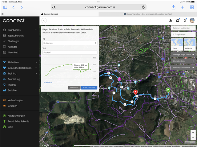
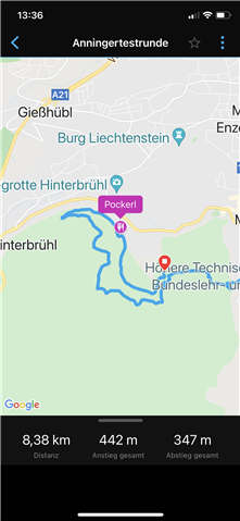
    I added a restaurant course point called „Pockerl“:


    Workflow:
    -open an existing course in Garmin Connect Web
    -Edit course
    -„add a coursepoint“ - give it a category and a name, tap on the map to fix location
    -save

    -open Garmin Connect Mobile and turn on Edge
    -open the course in GCM
    -send to device Edge

    Enjoy!

  • Yes I've done that. It shows on the map but I do not get a distance to go to the labelled point on the 1030 when navigating a course in any of the data fields when it is sent as a gpx. As you can only send gpx from GC to 1030 not TCX or FIT files then that's why I used a cable and exported it as a TCX file. I may try FIT files too. 

  • You can’t use GPX. 

    FIT and TCX work the same way.


    GC should be sending the file as FIT. 

    What data field are you using?

    Only “crs pt dist” will work. 

  • Yes I'm using "crs pt dist". 

    I know gpx files don't work as you have explained on this forum before. 

    I often use GC on a mobile does that send as a FIT

  • During my described workflow I never had to handle a file. It‘s all automatically from device to device (without copy and paste).

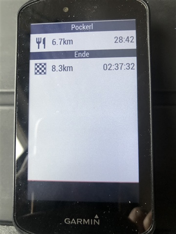
    After loading the course (with restaurant „Pockerl“) there is an additional screen when scrolling the screens:

    Here you can see the distance to „Pockerl“.

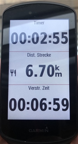
    But you‘re right - I did not manage to show this value in a datafield, since I found only „distance to next (waypoint)“ - which does not work.

  • I know gpx files don't work as you have explained on this forum before. 

    ??? You talked about using GPX just two hours ago. Why?

    I often use GC on a mobile does that send as a FIT

    ??? You talked about GC only sending GPX 2 hours ago. GC sends FIT files to the device. Not TCX. Not GPX.

  • The data field is "Crs Pt Dist" (Course Point Distance).

    I tried this too using GC on the web and everything works fine (including the data field). You have to have be recording to get the distance.

    I'm not sure what Dawesboy's issue is. He keeps talking about using GPX.

    "Distance to next" is for turn guidance (the big white arrows).

  • Perfect! Thanks!