Lets hear some reviews, comments about the maps feature

Former Member
Former Member
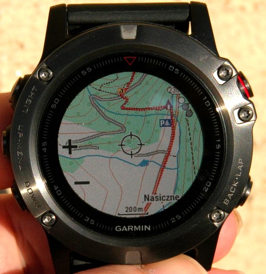
How do you like the presentation of the maps on your screen?
Speed of loading maps?
How often do you see yourself using them?

Anything you would like to share is appreciated.

for me, i am still leaning towards what looks better and I prefer the 5 silver. not fond of the blue-grey strap, but I think it lends itself better to some leather bands, or even orange, black, or even a nice heavy stainless steel band in the future.

I own a Fenix 2 that is non saphire and have one small scratch on it, plus its all black. so why the black or slate grey don't appeal to me as much. Im trying to convince myself that its time to replace the strap for built in.
  • Former Member
    0 Former Member over 8 years ago
    You don't feel the round screen is limiting for map viewing?

    I was afraid of it. But I already like round screen for the map :-)

  • The 5x comes with a few different maps. Cycle, 100k, Grand canyon....I deleted all of them and just put my 24k routable maps on there. I know coming from an Epix, the more maps you had on there the slower it was so I wasnt going to use those maps anyways. The 24k maps load very fast and look good. I still think Garmin Connect and Basecamp are horrible to use for routes. I use Suunto or ridewithgps web site to create a GPX files and import it into basecamp. From here I add waypoints and whatnot. Very happy with it so far. Cant wait to get out in the woods with it.
  • Ok, I used garmin's mapinstall app to add sections of a 24k topo map to the watch. I also added a POI and route using basecamp. The POI and route both display correctly. The topo map shows the road and trail fine, but does not display the elevation contour lines. There should be quite a few in the screenshot below.

    I've used this same topo map with the Fenix 1 and 2 without issue, so I'm not sure why it's different now.


    Are you sure its displaying the right map? You can select which one you want it to display(24k). I just made it easy and just uninstalled all of them and kept the 24k on there.
  • Are you sure its displaying the right map? You can select which one you want it to display(24k). I just made it easy and just uninstalled all of them and kept the 24k on there.


    Ah, thanks newb mistake. I forgot Garmin has separate map settings per activity. Turned off the others in my trail running activity and all is good now. Thanks!

  • Do you have to buy the garmin 24k maps to get elevation profiles or are there other options that include working elevation? It doesn't look like my abovethetimber 24k topo has dem data.

    I'm surprised how readable and usable the mapping feature is with the 5x. Coming from having used the fenix 1 and 2. Zooming and Panning is really quick and pretty easy. Hoping there is some sort of alerts for going off trail when navigating. I recall something like this with the early fenix line.
  • Looked at the manual for how to select which map(s) get overlaid and the option doesn't appear to be under Settings->Map.

    What am I missing?

    Nevermind -- I found it under each app setting.....
  • So the F5x comes with the 100k topo but most prefer the 24K so how do I get the 24K topo map? Also, I currently have a F3 with various courses saved on GC. When I get my F5x will those courses still be usable and simply overlay over a map instead of just the bread crumb I get on the F3? Thanks.
  • You can either buy the Garmin 24k assemblage or use one of the free ones that are around; the free ones are generally not routeable however while I believe Garmin's are. "Mapinstall" (a Garmin app) is used to push them to the watch (as with many other Garmin products.)

    I have several of the open source 24k maps loaded on my F5x at this point but have yet to give them a workout "in earnest"; I will report once I've had the chance to do it. At first blush it looks nice and appears to work well, but that's just looking around, not using it "in real life" (e.g. while hiking)
  • Back in 2013 Ray Maker did a primer on installing OSM maps on a Garmin Edge. Does it work the same way to get routable OSM maps for the 5X? Any unique steps or challenges, or can you pretty much follow Ray's advice step-by-step?