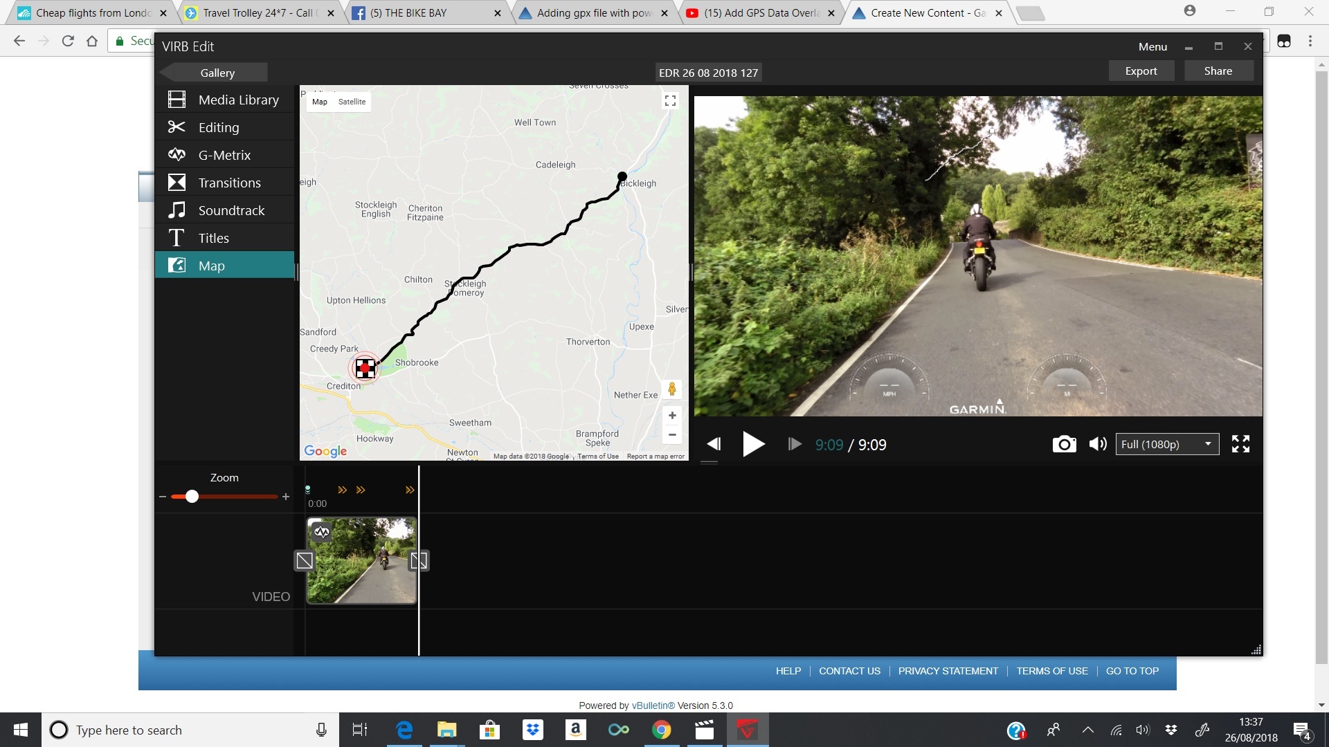
Is it possible to add an active map (google map) in virb edit so you can see the actual terrain/road as you can see when its imported and during creation rather than a white track line with the moving dot? ciq.forums.garmin.com/.../1394309.jpg
Yes, but its a pain in the butt.. You need to screen shot the map area in question, then add it to your video under the white line and resize it to make it line up..
Not easy but it works...
Why doesn't Garmin give us this option? Most likely because Google wants money for it since Gmaps isn't free anymore. However Open Streets Map is, so maybe they will look at that at some point.
There are legal reasons Garmin is not allowed to export videos with a google map overlaid on it, so you're stuck with creative solutions like VFRDave's. Using Open Street Maps overlays is an idea that has been floated in the past, but its never gotten any traction
I figured out how to do this using ArcGIS relatively painlessly, but it would be a lot easier if Garmin would allow for this functionality
I don't use the camera for action shots like it's marketed for but rather for documenting while simultaneously collecting the 'where' information (geographic file). Here is a linkto a video where I use an aerial imagery file (not Google imagery) as a background for the track gauge. I also change the location of the gauge in the frame at 23:00.


